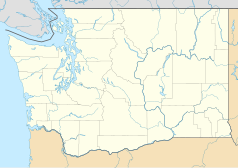
Smith Tower
 Smith Tower | |
| Państwo | |
|---|---|
| Miejscowość | Seattle |
| Adres | 506 Second Avenue at Yesler Way |
| Architekt | Gaggin & Gaggin |
| Wysokość całkowita | (489 ft) 149,0 m |
| Wysokość do dachu | (465 ft) 141,7 m |
| Kondygnacje | 39 |
| Rozpoczęcie budowy | 1910 |
| Ukończenie budowy | 1914 |
| Strona internetowa | |
Smith Tower – najstarszy wieżowiec w Seattle. Budowa 149-metrowego budynku rozpoczęła się w roku 1910. Po ukończeniu budowy w roku 1914 budynek był czwartym co do wielkości drapaczem chmur na świecie. W latach 1914-1962 był najwyższym budynkiem na Zachodnim Wybrzeżu USA.
W roku 1974 budynek został kupiony przez Ivara Haglunda za 1,8 mln dolarów. W 1996 r. budynek został nabyty przez Samis Foundation, a w 2006 przeszedł w posiadanie Walton Street Capital.
Budynek dwukrotnie przechodził renowację, w roku 1986 i 1999.
Zobacz też
- lista najwyższych budynków w Seattle
- lista najwyższych budynków w Stanach Zjednoczonych
- lista najwyższych budynków na świecie
Linki zewnętrzne
Media użyte na tej stronie
Autor: Uwe Dedering, Licencja: CC BY-SA 3.0
Location map of the USA (without Hawaii and Alaska).
EquiDistantConicProjection:
Central parallel:
* N: 37.0° N
Central meridian:
* E: 96.0° W
Standard parallels:
* 1: 32.0° N
* 2: 42.0° N
Made with Natural Earth. Free vector and raster map data @ naturalearthdata.com.
Formulas for x and y:
x = 50.0 + 124.03149777329222 * ((1.9694462586094064-({{{2}}}* pi / 180))
      * sin(0.6010514667026994 * ({{{3}}} + 96) * pi / 180))
y = 50.0 + 1.6155950752393982 * 124.03149777329222 * 0.02613325650382181
      - 1.6155950752393982  * 124.03149777329222 *
     (1.3236744353715044  - (1.9694462586094064-({{{2}}}* pi / 180))
      * cos(0.6010514667026994 * ({{{3}}} + 96) * pi / 180))
The flag of Navassa Island is simply the United States flag. It does not have a "local" flag or "unofficial" flag; it is an uninhabited island. The version with a profile view was based on Flags of the World and as a fictional design has no status warranting a place on any Wiki. It was made up by a random person with no connection to the island, it has never flown on the island, and it has never received any sort of recognition or validation by any authority. The person quoted on that page has no authority to bestow a flag, "unofficial" or otherwise, on the island.
Autor: Alexrk2, Licencja: CC BY 3.0
Ta mapa została stworzona za pomocą GeoTools.
Autor: Christopher S. Maloney (NorthLights), Licencja: CC BY 2.5
Straighten and crop of Image:SmithTower Seattle WA USA.jpg


