Snowdon
 Snowdon | |
| Państwo | |
|---|---|
| Księstwo | |
| Położenie | |
| Pasmo | |
| Wysokość | 1085 m n.p.m. |
| Wybitność | 1038 m |
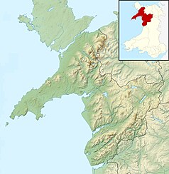
Położenie na mapie Gwynedd Contains Ordnance Survey data © Crown copyright and database right, CC BY-SA 3.0 | |
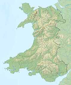
Położenie na mapie Walii Contains Ordnance Survey data © Crown copyright and database right, CC BY-SA 3.0 | |
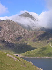
Snowdon (wal. Yr Wyddfa, wym. [əɾ ˈwɪðva]) – najwyższy szczyt Gór Kambryjskich i jednocześnie najwyższy szczyt Walii, położony w Gwynedd. Wznosi się na wysokość 1085 m n.p.m. Od 1951 góra objęta jest parkiem narodowym.
Snowdon jest wyjątkowo atrakcyjnym punktem widokowym, choć często panują tu mgły.
Nazwa
Nazwa oznacza "śnieżną górę", choć od roku 1994 ilość śniegu na szczycie zmniejszyła się o 55 procent.
Szlaki turystyczne
- Na szczyt można dostać się zębatą kolejką parową ze stacji Llanberis – największą atrakcją turystyczną regionu (wybudowaną w r. 1895)[1]. Długość linii – 7,5 km, czas wjazdu ok. 55 minut.
- Najpopularniejszy szlak turystyczny (nieznakowany) prowadzi z Llanberis łagodnym wzniesieniem, wzdłuż trasy kolejki. Czas wejścia – ok. 3 godzin.
- Trudny, lecz krajobrazowo urozmaicony szlak prowadzi z Pen-y-Pass na szczyt północną granią góry.
Zobacz też
Przypisy
- ↑ The beginning. [dostęp 2009-11-19]. [zarchiwizowane z tego adresu (14 marca 2010)]. (ang.).
Media użyte na tej stronie
Autor: Alexrk2, Licencja: CC BY-SA 3.0
Location map of the United Kingdom
Black up-pointing triangle ▲, U+25B2 from Unicode-Block Geometric Shapes (25A0–25FF)
Flag of England. Saint George's cross (a red cross on a white background), used as the Flag of England, the Italian city of Genoa and various other places.
Ulster Banner is a heraldic banner taken from the former coat of arms of Northern Ireland. It was used by the Northern Ireland government in 1953-1973 with Edwardian crown since coronation of Queen Elizabeth II, based earlier design with Tudor Crown from 1924. Otherwise known as the Ulster Flag, Red Hand of Ulster Flag, Red Hand Flag.
Ulster Banner is a heraldic banner taken from the former coat of arms of Northern Ireland. It was used by the Northern Ireland government in 1953-1973 with Edwardian crown since coronation of Queen Elizabeth II, based earlier design with Tudor Crown from 1924. Otherwise known as the Ulster Flag, Red Hand of Ulster Flag, Red Hand Flag.
Contains Ordnance Survey data © Crown copyright and database right, CC BY-SA 3.0
Relief map of Wales, UK.
Equirectangular map projection on WGS 84 datum, with N/S stretched 170%
- West: 5.5W
- East: 2.5W
- North: 53.5N
- South: 51.3N
Contains Ordnance Survey data © Crown copyright and database right, CC BY-SA 3.0
Relief map of Gwynedd, UK.
Equirectangular map projection on WGS 84 datum, with N/S stretched 165%
Geographic limits:
- West: 4.85W
- East: 3.4W
- North: 53.4N
- South: 52.5N


