Soest (Holandia)
| Ten artykuł od 2014-04 wymaga zweryfikowania podanych informacji. |
| |||||
 | |||||
| Państwo | |||||
|---|---|---|---|---|---|
| Prowincja | |||||
| Burmistrz | Rob Metz (2014)[1] | ||||
| Powierzchnia | 46,43 km² | ||||
| Populacja (2015) • liczba ludności • gęstość | 45 376 981 os./km² | ||||
| Nr kierunkowy | 035 (033/0346) | ||||
| Kod pocztowy | 3760-3769 | ||||
 | |||||
| Strona internetowa | |||||
Soest – miasto i gmina w środkowej Holandii. W 2015 r. miasto na powierzchni 46,43 km² zamieszkiwało 45 376 osób. Stanowi ośrodek przemysłu metalowego, papierniczego, skórzanego oraz ceramicznego.
Przypisy
- ↑ soest.nl: R.T. Metz (niderl.). [dostęp 2014-07-12]. [zarchiwizowane z tego adresu (2013-04-06)].
Media użyte na tej stronie
Autor: Janwillemvanaalst, Licencja: CC BY-SA 4.0
Topografische gemeentekaart. Resolutie: 400 pixels/km.
Kaartbeeld samengesteld uit de open geodata van de Top10NL en Top25namen (Kadaster), Creative Commons-BY licentie. Gebouwvlakken uit open geodata BAG extract. Wegen uit de OpenStreetMap, OpenStreetMap community. Reliëfschaduw uit de Actuele Hoogtekaart AHN2.
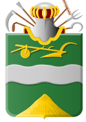
Samenstelling en kleurenschema: Jan-Willem van Aalst, met QGIS. Zie ook de Legenda.Coat of arms of the Dutch municipality of Soest.
Autor: Erik Frohne, Licencja: CC BY-SA 3.0
Location map of province Utrecht in the Netherlands
Equirectangular projection, N/S stretching 163 %. Geographic limits of the map:
- N: 52.40° N
- S: 51.90° N
- W: 4.70° E
- E: 5.70° E
Flag of the Dutch municipality of Soest
Autor: Marlies Bouten, Licencja: CC BY-SA 3.0 nl
To jest zdjęcie holenderskiego zabytku (rijksmonument) numer 34107


