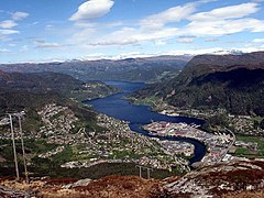
Sogn og Fjordane
| okręg | |||||
 | |||||
| Państwo | |||||
|---|---|---|---|---|---|
| Region | |||||
| Siedziba | |||||
| Kod ISO 3166-2 | NO-14 | ||||
| Powierzchnia | 18 623 km² | ||||
| Populacja (2019) • liczba ludności |
| ||||
| • gęstość | 5,89 os./km² | ||||
Położenie na mapie Norwegii | |||||
| Portal | |||||
Sogn og Fjordane – dawny okręg, jednostka podziału administracyjnego Norwegii. Przestał istnieć 1 stycznia 2020, gdy na podstawie reformy z 2017 został włączony, wraz z okręgiem Hordaland, do nowo utworzonego okręgu Vestland[1].
Położony był w południowej części kraju; graniczył z norweskimi okręgami Buskerud, Hordaland, Møre og Romsdal oraz Oppland. Zajmował powierzchnię 18 623 km², która zamieszkiwana była przez 109 774 osób (2019). Ośrodkiem administracyjnym okręgu było miasto Leikanger[2].
Gminy
Okręg podzielony był na 26 gmin[2].
Przypisy
- ↑ Ole T. Berg i inni, Fylke, [w:] Store Norske leksikon [online] [dostęp 2022-03-20] (norw. bokmål).
- ↑ a b Svein Askheim, Geir Thorsnæs, Sogn og Fjordane (tidligere fylke), [w:] Store Norske leksikon [online] [dostęp 2022-03-20] (norw. bokmål).
Linki zewnętrzne
- strona internetowa Sogn og Fjordane (archiwalna). sf-f.kommune.no. [zarchiwizowane z tego adresu (2005-03-13)].
- Firda – największa gazeta okręgu
Media użyte na tej stronie
(c) I, Sogning, CC-BY-SA-3.0
Map of the municipalities of Sogn og Fjordane County in Norway.
Created by Rarelibra for public domain use.(changed to less air around the picture)Coat of arms for Sogn og Fjordane county (fylke), Norway.The coat of arms were granted on 23 September 1983. The arms show the geographical layout of the county: three large fjords protruding into the land. The three fjords are the Nordfjord, Sunnfjord and Sognefjord. As nearly all villages and towns are situated on one of these fjords and the name of the county is based on the fjords.
Flag of Sogn og Fjordane, Norway.
Autor: TUBS
Location of county/ region xy (see filename) in Norway.


