Soisy-sous-Montmorency
| miejscowość i gmina | |||
 | |||
| |||
| Państwo | |||
|---|---|---|---|
| Region | |||
| Departament | |||
| Okręg | |||
| Kod INSEE | 95598 | ||
| Powierzchnia | 3,98 km² | ||
| Populacja (2007) • liczba ludności |
| ||
| • gęstość | 4377 os./km² | ||
| Kod pocztowy | 95230 | ||
Położenie na mapie Doliny Oise (c) Eric Gaba, Wikimedia Commons user Sting, CC BY-SA 3.0 | |||
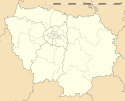
Położenie na mapie Île-de-France (c) Eric Gaba, Wikimedia Commons user Sting, CC BY-SA 3.0 | |||
| Portal | |||
Soisy-sous-Montmorency – miejscowość i gmina we Francji, w regionie Île-de-France, w departamencie Dolina Oise.
Według danych na rok 2007 gminę zamieszkiwało 17 419 osób, a gęstość zaludnienia wynosiła 4377 osób/km².
Bibliografia
- Jacques Hennequin, Soisy – promenade dans le passé, Éditions du Valhermeil, 1994
- Michel Rival, Le Refoulons ou le chemin de fer d’Enghien à Montmorency, Éditions du Valhermeil, Auvers-sur-Oise, 1989
- Charles Lefeuve, Histoire de la vallée de Montmorency. Le tour de la vallée, 1856, réédition du Cercle historique et archéologique d’Eaubonne et de la vallée de Montmorency en 1984
Linki zewnętrzne
Media użyte na tej stronie
(c) Eric Gaba, Wikimedia Commons user Sting, CC BY-SA 3.0
Blank administrative map of the department of Val-d'Oise, France, as in January 2015, for geo-location purpose, with distinct boundaries for regions, departments and arrondissements.
Autor: Superbenjamin, Licencja: CC BY-SA 4.0
Blank administrative map of France for geo-location purpose, with regions and departements distinguished. Approximate scale : 1:3,000,000
(c) Eric Gaba, Wikimedia Commons user Sting, CC BY-SA 3.0
Blank administrative map of the region of Île-de-France, France, as in January 2015, for geo-location purpose, with distinct boundaries for regions, departments and arrondissements.
Autor: Clicsouris, Licencja: CC BY-SA 2.5
L'hôtel-de-ville - Soisy-sous-Montmorency (France) -
Autor: Peter Potrowl, Licencja: CC BY 2.5
Insignia of Soisy-sous-Montmorency (Val d'Oise, France)


