Sorell Council
| Państwo | |
|---|---|
| Stan | |
| Burmistrz | Carmel Torenius |
| Powierzchnia | 582,6 km² |
| Populacja (2007) • liczba ludności • gęstość |
|
 | |
| Strona internetowa | |
| Portal | |
Sorell Council – obszar samorządu lokalnego (ang. local government area), położony na wschód od aglomeracji Hobart, główne miasto tego regionu to Sorell, gdzie również zlokalizowana jest siedziba samorządu. Na obszarze samorządu zlokalizowane są także odległe przedmieścia aglomeracji Hobart - Midway Point[2].
Sorell Council zamieszkuje 12 428[1] osób, powierzchnia samorządu wynosi 582,6 km²[3].
W celu identyfikacji samorządu Australian Bureau of Statistics wprowadziło czterocyfrowy kod dla gminy Sorell – 4810[4].
Zobacz też
- Podział aglomeracji Hobart
Przypisy
- ↑ a b Regional Population Growth, Australia, 2006-07
- ↑ Localities by Council, Local Government Association of Tasmania. lgat.tas.gov.au. [zarchiwizowane z tego adresu (2016-03-04)]., [dostęp 19 czerwca 2010]
- ↑ National Regional Profile: Sorell (M) (Local Government Area), [dostęp 19 czerwca 2010]
- ↑ Australian Bureau of Statistics. Alphabetic list of Local Government Areas (LGAs) and Statistical Local Areas (SLAs) – Tasmania, [dostęp 30 września 2011].
Media użyte na tej stronie
Autor: NordNordWest, Licencja: CC BY-SA 3.0 de
Location map of Tasmania, Australia
Autor: Squiresy92 including elements from Sodacan, Licencja: CC BY-SA 4.0
The Tasmanian Coat of Arms
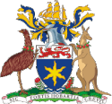
The Coat of arms of the city of Hobart (Tasmania) : Azure an Estoile Or on a Chief Argent a Lion passant Gules. Crest: On a Wreath Argent and Azure A three masted sailing Ship in full sail Or, Mantled Azure doubled Or. Supporters: On the dexter side an Emu and on the sinister side a Kangaroo both reguardant and each gorged with a chaplet of Apples leaved all proper. Motto: Sic Fortis Hobartia Crevit.


