Soto del Real
| |||
 | |||
| |||
| Państwo | |||
| Wspólnota autonomiczna | |||
| Burmistrz | Juan Lobato Gandarias (PSOE) | ||
| Powierzchnia | 42,17 km² | ||
| Wysokość | 921 m n.p.m. | ||
| Populacja (2009) • liczba ludności • gęstość | 8 294 196,68 os./km² | ||
| Kod pocztowy | 28791 | ||
| Tablice rejestracyjne | M | ||
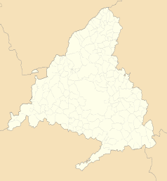
Położenie na mapie wspólnoty autonomicznej Madrytu (c) Miguillen, CC BY-SA 3.0 | |||
| Strona internetowa | |||
| Portal | |||
Soto del Real – miasto w Hiszpanii we wspólnocie autonomicznej Madryt, w południowej części gór Sierra de Guadarrama w paśmie Cuerda Larga.
Pod obecną nazwą funkcjonuje od 1959 r. poprzednio nazywało się Soto.
Media użyte na tej stronie
Autor: NordNordWest, Licencja: CC BY-SA 3.0
Location map of Spain
Equirectangular projection, N/S stretching 130 %. Geographic limits of the map:
- N: 44.4° N
- S: 34.7° N
- W: 9.9° W
- E: 4.8° E
Autor: Pedro A. Gracia Fajardo, escudo de Manual de Imagen Institucional de la Administración General del Estado, Licencja: CC0
Flaga Hiszpanii
Autor: See file history, Licencja: CC0
Flag of the Community of Madrid (Spain)
Autor: SanchoPanzaXXI, Licencja: CC BY-SA 4.0
Escudo municipal de Soto del Real (Madrid):"Escudo cortado. Primero, de sinople, tres chozas de oro, aclaradas de sable. Segundo, de oro, tres árboles, de sinople. Al timbre, Corona Real cerrada." [1]
Autor: Erfil, Licencja: CC BY-SA 3.0
View of the town of Soto del Real from the Cerro de la Berrocosa. It can be view too a little of the Cerro de San Pedro.


