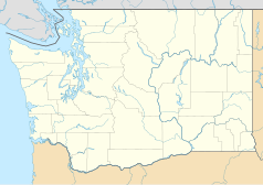
Spokane
 | |||
| |||
| Dewiza: Near Nature. Near Perfect. | |||
| Państwo | |||
|---|---|---|---|
| Stan | |||
| Hrabstwo | |||
| Burmistrz | David Condon | ||
| Powierzchnia | 151,6 km² | ||
| Wysokość | 724 m n.p.m. | ||
| Populacja (2000) • liczba ludności • gęstość |
| ||
| Nr kierunkowy | 509 | ||
| Kod pocztowy | 99201–99220 | ||
| Strona internetowa | |||
| Portal | |||
Spokane – miasto w Stanach Zjednoczonych, w stanie Waszyngton, nad rzeką Spokane. Około 200 tys. mieszkańców.
Miasto jest siedzibą dwóch prywatnych uniwersytetów: Gonzaga i Whitworth.
W mieście 19 czerwca 1910 roku po raz pierwszy obchodzono Dzień Ojca.
Ze Spokane pochodzi astronautka Anne McClain.
Demografia
Sport
- Spokane Chiefs – klub hokejowy
Miasta partnerskie
 Nishinomiya, Japonia
 Limerick, Irlandia
 Chech'ŏn, Korea Południowa
 Jilin, Chińska Republika Ludowa
 Machaczkała, Rosja
 Lubeka, Niemcy
Linki zewnętrzne
- Oficjalna strona miasta (ang.)
Media użyte na tej stronie
Autor: Uwe Dedering, Licencja: CC BY-SA 3.0
Location map of the USA (without Hawaii and Alaska).
EquiDistantConicProjection:
Central parallel:
* N: 37.0° N
Central meridian:
* E: 96.0° W
Standard parallels:
* 1: 32.0° N
* 2: 42.0° N
Made with Natural Earth. Free vector and raster map data @ naturalearthdata.com.
Formulas for x and y:
x = 50.0 + 124.03149777329222 * ((1.9694462586094064-({{{2}}}* pi / 180))
      * sin(0.6010514667026994 * ({{{3}}} + 96) * pi / 180))
y = 50.0 + 1.6155950752393982 * 124.03149777329222 * 0.02613325650382181
      - 1.6155950752393982  * 124.03149777329222 *
     (1.3236744353715044  - (1.9694462586094064-({{{2}}}* pi / 180))
      * cos(0.6010514667026994 * ({{{3}}} + 96) * pi / 180))
The flag of Navassa Island is simply the United States flag. It does not have a "local" flag or "unofficial" flag; it is an uninhabited island. The version with a profile view was based on Flags of the World and as a fictional design has no status warranting a place on any Wiki. It was made up by a random person with no connection to the island, it has never flown on the island, and it has never received any sort of recognition or validation by any authority. The person quoted on that page has no authority to bestow a flag, "unofficial" or otherwise, on the island.
Autor: Ron Reiring, Licencja: CC BY 2.0
Downtown Spokane, WA on approach to the airport.
Construction of Monroe Street Bridge, Spokane, Wash. On front under title: "Dimensions. Length of concrete work, 780 feet. Height of floor from water, 135 [feet]. Span of main arch, 281 [feet]. Engineers; J. C. Ralston, T. F. Kennedy, Morton MacCartney, J. F. Greene. Copyrighted A.D. 1911 by W. O. Reed, Spokane, Wash."
Flag of Spokane, Washington adopted May 10th, 2021, designed by Spokane resident Derek Landers
Autor: Alexrk2, Licencja: CC BY 3.0
Ta mapa została stworzona za pomocą GeoTools.


