St. Albert (Alberta)
| ||
 | ||
| Państwo | ||
| Prowincja | ||
| Powierzchnia | 35,04 km² | |
| Populacja (2006) • liczba ludności | 57 719 | |
| Strona internetowa | ||
| Portal | ||
St. Albert - miasto w Kanadzie, w prowincji Alberta. W 2006 miasto miało 35,04 km² powierzchni i zamieszkiwało je 57 719 osób.
Media użyte na tej stronie
Autor: Yug, Licencja: CC-BY-SA-3.0
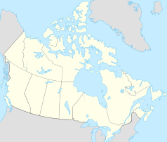
cropped version of Carte administrative du Canada.svg for map location.
Autor: Hanhil (talk) 05:35, 24 September 2009 (UTC), Licencja: CC BY-SA 3.0
Location map of Alberta, Canada, showing the 19 census divisions.
Equirectangular projection, N/S stretching 170%. Geographic limits of the map:
- N: 60.3° N
- S: 48.7° N
- W: 123.0° W
- E: 107.0° W
Autor: en:User:Fellowedmonton, Licencja: CC BY-SA 3.0
St Albert Clocktower Downtown. Originally posted on Flickr; Licensed under Creative Commons Attribution-Sharelike 3.0 license; this photo originally uploaded to en: by en:User:Fellowedmonton; it is uploaded here to Commons by me User:Mr Accountable.
Flag of Alberta.


