St James Park
| ||
 | ||
| Przydomek: The Park, SJP | ||
| Państwo | ||
| Kraj | ||
| Miejscowość | Exeter | |
| Data budowy | 1904 | |
| Data otwarcia | 10 września 1904 | |
| Klub | Exeter City F.C. | |
| Pojemność stadionu | 8541 | |
Położenie na mapie Exeteru Contains Ordnance Survey data © Crown copyright and database right, CC BY-SA 3.0 | ||
Położenie na mapie Wielkiej Brytanii (c) Karte: NordNordWest, Lizenz: Creative Commons by-sa-3.0 de | ||
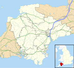
Położenie na mapie Devonu Contains Ordnance Survey data © Crown copyright and database right, CC BY-SA 3.0 | ||
St James Park – stadion piłkarski w mieście Exeter, w Anglii. Mecze domowe na tym obiekcie rozgrywa zespół Exeter City F.C.
Media użyte na tej stronie
(c) Karte: NordNordWest, Lizenz: Creative Commons by-sa-3.0 de
Location map of the United Kingdom
Flag of England. Saint George's cross (a red cross on a white background), used as the Flag of England, the Italian city of Genoa and various other places.
Autor:
- Gfi-set01-stadium.png: gfi
- derivative work: Frédéric (talk)
icone pour terrain de sport
Contains Ordnance Survey data © Crown copyright and database right, CC BY-SA 3.0
Map of Devon, UK with the following information shown:
- Administrative borders
- Coastline, lakes and rivers
- Motorways and primary routes
- Urban areas
Equirectangular map projection on WGS 84 datum, with N/S stretched 150%
Geographic limits:
- West: 4.72W
- East: 2.86W
- North: 51.3N
- South: 50.16N
Contains Ordnance Survey data © Crown copyright and database right, CC BY-SA 3.0
Map of Exeter, Devon, UK with electoral wards as of 2016 shown.
Equirectangular map projection on WGS 84 datum, with N/S stretched 150%
Geographic limits:
- West: 3.58W
- East: 3.45W
- North: 50.77N
- South: 50.66N
Autor: en:User:Rowan_Massey, Licencja: CC BY 2.5
St James Park, football stadium in Exeter, Devon


