Stade Bouaké
| ||
 Stadion w trakcie przebudowy | ||
| Państwo | ||
| Miejscowość | Bouaké | |
| Pojemność stadionu | 35 000 | |
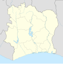
Położenie na mapie Wybrzeża Kości Słoniowej | ||
Stade Bouaké – wielofunkcyjny stadion w Bouaké na Wybrzeżu Kości Słoniowej. Najczęściej pełni rolę areny piłkarskiej. Obiekt może pomieścić 35 000 widzów.
Media użyte na tej stronie
(c) Uwe Dedering z niemieckiej Wikipedii, CC BY-SA 3.0
Location map of Côte d'Ivoire Equirectangular projection.
Strechted by 101%. Geographic limits of the map:
- N: 11° N
- S: 4° N
- W: 9° W
- E: 2° W
Flag of the Ivory Coast, written by Jon Harald Søby, modified by Zscout370. The colors match to what is reported at http://fotw.vexillum.com/flags/ci.html.
Autor:
- Gfi-set01-stadium.png: gfi
- derivative work: Frédéric (talk)
icone pour terrain de sport
Autor: Oryginalnym przesyłającym był Francky Dicaprio z francuskiej Wikipedii, Licencja: CC BY-SA 2.5
source : photo personnelle


