Stadion Pietrowski
(c) Alex 'Florstein' Fedorov, CC BY-SA 4.0 Widok na Stadion Pietrowski | |
| Państwo | |
|---|---|
| Miasto wydzielone | |
| Adres | |
| Data otwarcia | |
| Klub | |
| Pojemność stadionu | 21 570 |
| Nawierzchnia boiska | trawa |
| Strona internetowa | |
Stadion Pietrowski - stadion zespołu Zenit Petersburg wybudowany w 1925. Może pomieścić 21 570 osób[1].
Przypisy
- ↑ Pojemność stadionu. [dostęp 2011-08-31].
Bibliografia
- Informacja o stadionie na World Stadiums. worldstadiums.com. [zarchiwizowane z tego adresu (2015-09-05)]. (ang.)
Media użyte na tej stronie
Autor: Uwe Dedering, Licencja: CC BY-SA 3.0
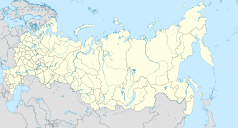
Location map of Russia.
EquiDistantConicProjection : Central parallel :
* N: 54.0° N
Central meridian :
* E: 100.0° E
Standard parallels:
* 1: 49.0° N
* 2: 59.0° N
Made with Natural Earth. Free vector and raster map data @ naturalearthdata.com.
Because the southern Kuril islands are claimed by Russia and Japan, they are shown as disputed. For more information about this see: en:Kuril Islands dispute. These islands are since 1945 under the jurisdiction of the Russian Federation.
Flag of Saint Petersburg, Russia
Autor:
- Gfi-set01-stadium.png: gfi
- derivative work: Frédéric (talk)
icone pour terrain de sport
(c) Alex 'Florstein' Fedorov, CC BY-SA 4.0
Petrovskiy football stadium in Saint Petersburg
Autor: Autor nie został podany w rozpoznawalny automatycznie sposób. Założono, że to Obersachse (w oparciu o szablon praw autorskich)., Licencja: CC-BY-SA-3.0
Object: Saint Petersburg
- Description: Saint Petersburg locator map
- Author: Obersachse
- Created: 2007-05-16
- Source: image:Spb all districts 2005 abc rus.svg, drawn by Panther using Corel Draw


