Stok Kangri
| Ten artykuł od 2010-10 wymaga zweryfikowania podanych informacji. |
| ||
 | ||
| Państwo | ||
| Położenie | Ladakh | |
| Pasmo | Himalaje | |
| Wysokość | 6 137 m n.p.m. | |
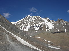
Stok Kangri (wysokość 6.137 m) jest najwyższym szczytem w Himalajach Ladakhu w północno-zachodnich Indiach w stanie Dżammu i Kaszmir. Szczyt ten znajduje się w Parku Narodowym Hemis, 24 km na południowy zachód od Leh - stolicy krainy Ladakh. Ze szczytu rozciąga się wspaniały widok na Zanskar, Karakorum i drugą górę świata K2 (8611 m).
Media użyte na tej stronie
The Flag of India. The colours are saffron, white and green. The navy blue wheel in the center of the flag has a diameter approximately the width of the white band and is called Ashoka's Dharma Chakra, with 24 spokes (after Ashoka, the Great). Each spoke depicts one hour of the day, portraying the prevalence of righteousness all 24 hours of it.
Black up-pointing triangle ▲, U+25B2 from Unicode-Block Geometric Shapes (25A0–25FF)
Autor: Uwe Dedering, Licencja: CC BY-SA 3.0
Location map of India.
Equirectangular projection. Stretched by 106.0%. Geographic limits of the map:
- N: 37.5° N
- S: 5.0° N
- W: 67.0° E
- E: 99.0° E
Stok Kangri, Ladakh. Photo taken by me on expedition (uploader), July 2005. Not copyrighted, but am putting it into public domain by posting it here.
Autor:
- India_Jammu_and_Kashmir_location_map.svg: NordNordWest
- derivative work: Avoided blue (talk)
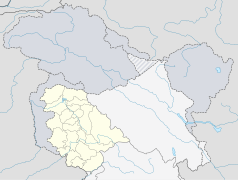
Location map of Jammu and Kashmir, India. De facto situation.


