Stratford-on-Avon (dystrykt)
| dystrykt niemetropolitalny | |
 Stratford-upon-Avon | |
| Państwo | |
|---|---|
| Kraj | |
| Region | West Midlands |
| Hrabstwo | Warwickshire |
| Siedziba | Stratford-upon-Avon |
| Powierzchnia | 977,9 km² |
| Populacja (2011) • liczba ludności | 120 485 |
| • gęstość | 120 os./km² |
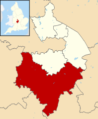
Położenie na mapie Warwickshire | |
| Strona internetowa | |
| Portal | |
Stratford-on-Avon – dystrykt w hrabstwie Warwickshire w Anglii. W 2011 roku dystrykt liczył 120 485 mieszkańców[1].
Miasta
Inne miejscowości
Abbot's Salford, Admington, Alderminster, Arlescote, Armscote, Arrow with Weethley, Arrow, Ashorne, Aston Cantlow, Atherstone on Stour, Avon Dassett, Barcheston, Barton-on-the-Heath, Bearley, Beaudesert, Bidford-on-Avon, Billesley, Binton, Bishop’s Itchington, Brailes, Burmington, Butlers Marston, Cherington, Chesterton, Claverdon, Clifford Chambers, Combrook, Coughton, Darlingscott, Earlswood, Ettington, Exhall, Fenny Compton, Gaydon, Gorcott Hill, Great Alne, Hampton Lucy, Harbury, Haselor, Ilmington, Kineton, Kinwarton, Ladbroke, Lighthorne Heath, Long Compton, Long Itchington, Long Marston, Lower Shuckburgh, Lowsonford, Loxley, Luddington, Moreton Morrell, Morton Bagot, Napton on the Hill, Newbold-on-Stour, Oldberrow, Oxhill, Pathlow, Pillerton Hersey, Preston on Stour, Priors Hardwick, Quinton, Ratley, Salford Priors, Sambourne, Shottery, Shotteswell, Snitterfield, Spernall, Stockton, Stretton-on-Fosse, Studley, Tanworth-in-Arden, Temple Grafton, Temple Herdewyke, Tiddington, Tredington, Ullenhall, Upton, Walton, Warmington, Welford-on-Avon, Wellesbourne, Weston-on-Avon, Whatcote, Whichford, Whitchurch, Wilmcote, Wolverton, Wood End, Wootton Wawen.
Przypisy
- ↑ Area: Stratford-on-Avon (Local Authority) (ang.). Neighbourhood Statistics (ONS). [dostęp 2016-04-17]. [zarchiwizowane z tego adresu (2016-09-27)].
Media użyte na tej stronie
Flag of England. Saint George's cross (a red cross on a white background), used as the Flag of England, the Italian city of Genoa and various other places.
Autor: Glenluwin, Licencja: CC BY-SA 3.0
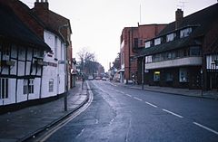
Row houses in Stratford-upon-Avon 1983
Autor:
- Warwickshire UK district map (blank).svg: Nilfanion, created using Ordnance Survey data
- derivative work: Renly (talk)
Map of Warwickshire, with Stratford-on-Avon highlighted.


