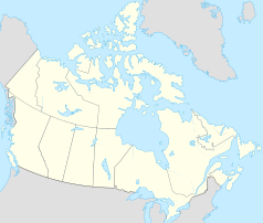
Sydney (Kanada)
| ||||
 | ||||
| Państwo | ||||
|---|---|---|---|---|
| Prowincja | ||||
| Prawa miejskie | 1884–1904 (town) | |||
| Powierzchnia | 23,49 km² | |||
| Populacja (1991) • liczba ludności |
| |||
| Strona internetowa | ||||
| Portal | ||||
Sydney (do 1784 La Baye des Espagnols/Spanish Harbour) – miejscowość (metropolitan area; 1884–1995 miasto – początkowo town, od 1904 city) w kanadyjskiej prowincji Nowa Szkocja, ośrodek hrabstwa Cape Breton[1]. Według spisu powszechnego z 2016 obszar miejski (population centre) Cape Breton – Sydney to: 29,43 km², a zamieszkiwało wówczas ten obszar 29 904 osoby[2].
Miejscowość, która pierwotnie nosiła miano ''La Baye des Espagnols lub Spanish Harbour, została w podobnym czasie (1784) stolicą kolonii Cape Breton oraz zmieniła nazwę na współcześnie używaną, by od 1820 być ośrodkiem hrabstwa Cape Breton, a w 1884 otrzymała status miasta (początkowo town, od 1904 city), który utraciła w 1995 w wyniku utworzenia regional municipality Cape Breton, siedziba Nova Scotia Eastern Institute of Technology (od 1974 University College of Cape Breton)[3].
Według spisu powszechnego z 1991 obszar miasta (city) to: 23,49 km², a zamieszkiwało wówczas ten obszar 26 063 osoby[4].
Przypisy
- ↑ Sydney, Natural Resources Canada / Ressources naturelles Canada – nrcan.gc.ca [dostęp 2021-05-12]; W.B. Hamilton, North Sydney; Sydney; Sydney Mines; Sydney River, [w:] W.B. Hamilton, Place Names of Atlantic Canada, Toronto–Buffalo–London: University of Toronto Press, 1996, s. 373.
- ↑ Cape Breton - Sydney [Population centre], Nova Scotia and Nova Scotia [Province] – Census Profile, 2016 Census, Statistics Canada / Statistique Canada – statcan.gc.ca [dostęp 2021-05-12].
- ↑ W.B. Hamilton, North Sydney; Sydney; Sydney Mines; Sydney River, [w:] W.B. Hamilton, Place Names of Atlantic Canada, Toronto–Buffalo–London: University of Toronto Press, 1996, s. 373.
- ↑ Sydney, C – Profile of Census Divisions and Subdivisions - Part A – 1991 Census Area Profiles, Statistics Canada / Statistique Canada – statcan.gc.ca [dostęp 2021-05-16].
Media użyte na tej stronie
Autor: Yug, Licencja: CC-BY-SA-3.0
cropped version of Carte administrative du Canada.svg for map location.
Autor: Hanhil (talk) 19:46, 23 September 2009 (UTC), Licencja: CC BY-SA 3.0
Location map of Nova Scotia, Canada
Autor: Abebenjoe, Licencja: CC BY-SA 3.0
Aerial view of Sydney Harbour. Top right of the photo contains the Sydney Coal Piers. The middle-right shows the government wharf where the Big Fiddle is located. The ship docked at the government wharf is the Canadian Coast Guard Icebreaker CCGS Louis S. St-Laurent. The lower-middle right is where the Civic Centre is, the home of the Cape Breton Regional Municipality government.
Flag of Nova Scotia.


