Szczeglin (przystanek kolejowy)
| ||
| Państwo | ||
|---|---|---|
| Miejscowość | Dąbrówka | |
| Dane techniczne | ||
| Kasy | ||
| Linie kolejowe | ||
Położenie na mapie Polski (c) Karte: NordNordWest, Lizenz: Creative Commons by-sa-3.0 de | ||
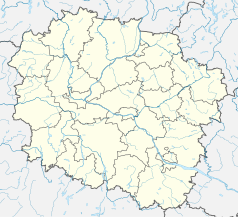
Położenie na mapie województwa kujawsko-pomorskiego (c) SANtosito, CC BY-SA 4.0 | ||
| Portal | ||
Szczeglin – nieczynny przystanek kolejowy w Dąbrówce, w województwie kujawsko-pomorskim, w Polsce.
Bibliografia
- Szczeglin w Ogólnopolskiej Bazie Kolejowej – bazakolejowa.pl
| Szczeglin | ||
| Linia 231. Inowrocław Rąbinek – Mogilno (50,613 km) | ||
odległość: 3,856 km | odległość: 4,617 km | |
Media użyte na tej stronie
Poland adm location map.svg
(c) Karte: NordNordWest, Lizenz: Creative Commons by-sa-3.0 de
Location map of Poland
(c) Karte: NordNordWest, Lizenz: Creative Commons by-sa-3.0 de
Location map of Poland
Kuyavian-Pomeranian Voivodeship location map.svg
(c) SANtosito, CC BY-SA 4.0
Location map of Kuyavian-Pomeranian Voivodeship. Geographic limits of the map:
(c) SANtosito, CC BY-SA 4.0
Location map of Kuyavian-Pomeranian Voivodeship. Geographic limits of the map:
- N: 53.83 N
- S: 52.28 N
- W: 17.16 E
- E: 19.88 E
BSicon KBHFl.svg
head station, track to the left
head station, track to the left
BSicon KBHFaq.svg
head station, track to the left
head station, track to the left
BSicon STRq.svg
Straight line aqross (according to naming convention, name + modifier)
Straight line aqross (according to naming convention, name + modifier)
BSicon BHFq.svg
station at track aqross
station at track aqross
BSicon KBHFr.svg
head station, track to the right
head station, track to the right
BSicon KBHFeq.svg
head station, track to the right
head station, track to the right
Mogilno (gmina) location map.png
Autor:
Mapa gminy Mogilno, Polska
Autor:
OpenStreetMap contributors
,
Licencja: CC BY-SA 2.0
Mapa gminy Mogilno, Polska
Mogilno County location map02.svg
Autor: SANtosito, Licencja: CC BY-SA 4.0
Location map of Mogilno County with urbanized area highlighted. Geographic limits of the map:
Autor: SANtosito, Licencja: CC BY-SA 4.0
Location map of Mogilno County with urbanized area highlighted. Geographic limits of the map:
- N: 52.85 N
- S: 52.47 N
- W: 17.77 E
- E: 18.37 E


