Szpital Salpêtrière
| Ten artykuł od 2008-04 wymaga zweryfikowania podanych informacji. |
 | |
| Państwo | |
|---|---|
| Region | |
| Miejscowość | Paryż |
| Typ budynku | szpital |
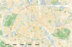
Położenie na mapie Paryża (c) Eric Gaba, Wikimedia Commons user Sting, CC BY-SA 3.0 | |
| Strona internetowa | |
Szpital Salpêtrière – szpital w Paryżu. Pierwotnie był fabryką prochu (stąd nazwa – fr. Salpêtrière od łac. sal petrae, czyli „sól skalna” – saletra, jeden ze składników prochu strzelniczego). W 1656 roku na mocy kwietniowego edyktu wydanego przez Ludwika XIV został przekształcony w przytułek dla ubogich. Służył także jako więzienie dla przestępców, prostytutek, niepełnosprawnych psychicznie, chorych psychicznie, epileptyków, libertynów. Był znany ze swej wielkiej populacji szczurów. W latach 1848–1893 w szpitalu praktykował Jean-Martin Charcot.
Media użyte na tej stronie
Autor: Superbenjamin, Licencja: CC BY-SA 4.0
Blank administrative map of France for geo-location purpose, with regions and departements distinguished. Approximate scale : 1:3,000,000
Blue Shield - the Distinctive emblem for the Protection of Cultural Property. The distinctive emblem is a protective symbol used during armed conflicts. Its use is restricted under international law.
Autor: Patricia.fidi, Licencja: CC0
Unofficial (de facto) flag of the region Île-de-France in France. It was also the flag of the kingdom of France (s.XIV-XV)
Autor: Thibault Pelloquin, Licencja: CC BY-SA 3.0
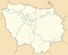
Cette carte représente l'Île de France (en jaune pâle), ses limites départementales et régionales (en traits gris) et ses principaux cours et points d'eau (en bleu). Les départements limitrophes (sont en rose-orange pâle)
(c) Eric Gaba, Wikimedia Commons user Sting, CC BY-SA 3.0
Blank land cover map of the city and department of Paris, France, as in January 2012, for geo-location purpose, with distinct boundaries for departments and arrondissements.
Photo of the Chapel at the en:Pitié-Salpêtrière Hospital, Paris. Photo by Vaughan 16:18, 5 March 2007 (UTC)


