Täsch
| |||||
 | |||||
| Państwo | |||||
| Kanton | |||||
| SFOS | 6295 | ||||
| Burmistrz | Christoph Imboden | ||||
| Powierzchnia | 58,72 km² | ||||
| Wysokość | 1449 m n.p.m. | ||||
| Populacja (2010) • liczba ludności • gęstość | 1126 19 os./km² | ||||
| Nr kierunkowy | 6295 | ||||
| Kod pocztowy | 3929 | ||||
| Tablice rejestracyjne | VS | ||||
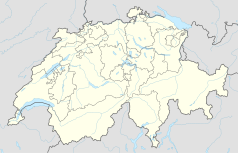
Położenie na mapie Szwajcarii (c) Karte: NordNordWest, Lizenz: Creative Commons by-sa-3.0 de | |||||
| Strona internetowa | |||||
Täsch – szwajcarska miejscowość i gmina w kantonie Valais, w dystrykcie Visp. Jest położona w dolinie Mattertal w Alpach Pennińskich, w pobliżu Zermatt. Kończy się tu droga prowadząca przez dolinę. Dalej do Zermatt można dojechać tylko pociagiem. Według ostatniego spisu ludności mieszkało tu 1126 osób[1].
Täsch jest dużą bazą narciarską i ośrodkiem sportowym. W 1985 roku odbyły się tutaj mistrzostwa świata juniorów w narciarstwie klasycznym.
Galeria
Przypisy
- ↑ Wanderkarte, Zermatt - Cervinia (Breuil) - Täsch, Bundesamt der Landestopographie, 1998
Linki zewnętrzne
- Informacje o Täsch na stronie Zermatt.ch (niem. • ang. • fr. • wł.)
Media użyte na tej stronie
Autor: Abaddon1337, Licencja: CC BY-SA 3.0
Fork from media:Karte Kanton Wallis Bezirke 2010.png for geolocalisation
(c) Karte: NordNordWest, Lizenz: Creative Commons by-sa-3.0 de
Location map of Switzerland
Flag of Canton of Valais (Switzerland). The black contours around the stars and along the division of the field are not usually seen in cantonal flags and are an artefact of this representation reflecting the image used for the pdf of the federal Fahnenreglement of 2007.
Drapeau de la commune de Zollikon
Autor: Oryginalnym przesyłającym był Renatobucher z niemieckiej Wikipedii, Licencja: CC-BY-SA-3.0
Helikopteraufnahme von Täsch VS, von renatobucher
Täsch im Winter


