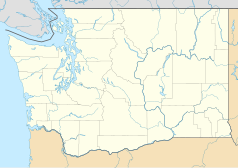
T-Mobile Park
 | |
| Państwo | |
|---|---|
| Miejscowość | |
| Architekt | NBBJ[1] |
| Koszt budowy | 517 milionów dolarów[1] |
| Klub | |
| Inauguracja | 15 lipca 1999 |
| Pojemność stadionu | 47 477[1] |
T-Mobile Park – stadion baseballowy w Seattle w stanie Waszyngton, na którym swoje mecze rozgrywa zespół Seattle Mariners.
Budowę obiektu rozpoczęto w marcu 1997 nieopodal wielofunkcyjnego, zburzonego w 2000 roku stadionu Kingdome[2]. W czerwcu 1998 prawa do nazwy obiektu wykupiła za 40 milionów dolarów firma Safeco[2]. Pierwszy mecz na Safeco Field odbył się 31 marca 2003; przeciwnikiem Mariners był San Diego Padres, a spotkanie obejrzało 47 000 widzów[2]. 10 lipca 2001 na stadionie odbył się 72. MLB All-Star Game, w którym wystąpił ośmiu zawodników Mariners, a jednym z trenerów drużyny American League All-Stars był Lou Piniella menadżer zespołu z Seattle[2].
Na stadionie miały miejsce także mecze rozgrywek akademickich futbolu amerykańskiego, mecze piłkarskie, a także koncerty, między innymi Paula McCartneya i The Beach Boys[3][4].
Do 19 grudnia 2018 stadion nosił nazwę Safeco Field[5].
Widok na Safeco Field i CenturyLink Field ze Space Needle.
Przypisy
- ↑ a b c Safeco Field, Seattle, WA. ballparksofbaseball.com. [dostęp 2014-06-19]. (ang.).
- ↑ a b c d Safeco Field History. mariners.mlb.com. [dostęp 2014-06-19]. [zarchiwizowane z tego adresu (29 listopada 2014)]. (ang.).
- ↑ Infield of Safeco Field Being Sodded for U.S.-Honduras Match on March 2. ussoccer.com. [dostęp 2014-06-19]. (ang.).
- ↑ Paul McCartney to perform 1st public concert at Safeco Field on July 19. foxnews.com. [dostęp 2014-06-19]. (ang.).
- ↑ Mariners' home facility renamed T-Mobile Park. mlb.com. [dostęp 2018-12-19]. (ang.).
Media użyte na tej stronie
Autor: Uwe Dedering, Licencja: CC BY-SA 3.0
Location map of the USA (without Hawaii and Alaska).
EquiDistantConicProjection:
Central parallel:
* N: 37.0° N
Central meridian:
* E: 96.0° W
Standard parallels:
* 1: 32.0° N
* 2: 42.0° N
Made with Natural Earth. Free vector and raster map data @ naturalearthdata.com.
Formulas for x and y:
x = 50.0 + 124.03149777329222 * ((1.9694462586094064-({{{2}}}* pi / 180))
      * sin(0.6010514667026994 * ({{{3}}} + 96) * pi / 180))
y = 50.0 + 1.6155950752393982 * 124.03149777329222 * 0.02613325650382181
      - 1.6155950752393982  * 124.03149777329222 *
     (1.3236744353715044  - (1.9694462586094064-({{{2}}}* pi / 180))
      * cos(0.6010514667026994 * ({{{3}}} + 96) * pi / 180))
The flag of Navassa Island is simply the United States flag. It does not have a "local" flag or "unofficial" flag; it is an uninhabited island. The version with a profile view was based on Flags of the World and as a fictional design has no status warranting a place on any Wiki. It was made up by a random person with no connection to the island, it has never flown on the island, and it has never received any sort of recognition or validation by any authority. The person quoted on that page has no authority to bestow a flag, "unofficial" or otherwise, on the island.
Autor:
- Gfi-set01-stadium.png: gfi
- derivative work: Frédéric (talk)
icone pour terrain de sport
(c) 3bulletproof16, CC-BY-SA-3.0
Taken on July 20, 2006 at the Space Needle of Qwest Field, Safeco Field, and Mount Rainier.
05:50, 1 August 2006 . . 3bulletproof16 . . 2592 x 1728 (2,373,733 bytes)
Autor: Alexrk2, Licencja: CC BY 3.0
Ta mapa została stworzona za pomocą GeoTools.
Autor: Paul R. Kucher IV (User YF12s on en.wikipedia), Licencja: CC BY 2.5
17:44, 15 August 2006 . . YF12s . . 800×536 (145,614 bytes) (Safeco Field's Main Entrance. Photo taken on 27 July 2007 by Paul R. Kucher IV)
Safeco Field satellite view, nasa world wind 1.3.5


