Tafalla
 | |||||
| Państwo | |||||
|---|---|---|---|---|---|
| Wspólnota autonomiczna | |||||
| Burmistrz | Cristina Sota | ||||
| Powierzchnia | 98,29 km² | ||||
| Wysokość | 421 m n.p.m. | ||||
| Populacja (2007) • liczba ludności • gęstość |
| ||||
| Nr kierunkowy | 948 | ||||
| Kod pocztowy | 31300 | ||||
| Tablice rejestracyjne | NA | ||||
Położenie na mapie Nawarry (c) Miguillen, CC BY-SA 3.0 | |||||
| Strona internetowa | |||||
| Portal | |||||
Tafalla – miasto w Hiszpanii, we wspólnocie autonomicznej Nawarra. W 2007 liczyło 11 115 mieszkańców.
Media użyte na tej stronie
Autor: NordNordWest, Licencja: CC BY-SA 3.0
Location map of Spain
Equirectangular projection, N/S stretching 130 %. Geographic limits of the map:
- N: 44.4° N
- S: 34.7° N
- W: 9.9° W
- E: 4.8° E
Autor: Pedro A. Gracia Fajardo, escudo de Manual de Imagen Institucional de la Administración General del Estado, Licencja: CC0
Flaga Hiszpanii
Flag of Navarre (Spain) Article 7.2. of the LORAFNA stipulates: “The flag of Navarre is red, with the coat of arms in the centre. Source: Symbols of Navarre - Gobierno de Navarra
Autor: Nafarroako Gobernua, Licencja: CC BY 4.0
Tafallako ikuspegi orokorra
Autor: Miguillen, Licencja: CC BY-SA 3.0
Bandera de la ciudad de Tafalla (Navarra - España), proporciones 2/3 color blanco con una cruz de borgoña roja y el escudo de Tafalla en el centro en sus esmaltes. Escudo de Tafalla-Pagina web del Ayuntamiento
Autor: Heralder, elements from File:Escudo Tafalla.svg, Licencja: CC BY-SA 3.0
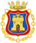
Coat of arms of Tafalla, Navarre (Spain)


