Tallahatchie
 Tallahatchie na południe od Minter City | |
| Kontynent | |
|---|---|
| Państwo | |
| Stan | |
| Rzeka | |
| Długość | 370 km |
| Ujście | |
| Recypient | |
| Miejsce | okolice Greenwood |
| Współrzędne | |
Tallahatchie – rzeka w stanie Missisipi w Stanach Zjednoczonych. Płynie na długości 370 km przez hrabstwa Tippah, Tallahatchie oraz Leflore[1]. Na północ od Greenwood, łączy się z rzeką Yalobusha, tworząc Yazoo, która później uchodzi do Missisipi.
Nazwa pochodzi prawdopodobnie z języka Czoktawów i oznacza "skalistą rzekę". Zapisywana była w wielu wariantach, m.in. Tallahatchee, Tallahatsie lub Talahatchey. Ostatecznie obecny wariant został zatwierdzony przez United States Board on Geographic Names w 1892 roku[1].
W górnym biegu, powyżej ujścia swoich dopływów Yocona oraz Coldwater, nazywana również Little Tallahatchie. W pobliżu miasta Sardis rzekę spiętrza zapora ziemna, tworząc jezioro Sardis.
W latach 1863–65 w Union Navy operował parowiec USS Tallahatchie[2].
Przypisy
- ↑ a b GNIS Detail - Tallahatchie River, geonames.usgs.gov [dostęp 2016-11-24].
- ↑ Naval History and Heritage Command: Tallachatchie
Źródła
- Tallahatchie River, [w:] Encyclopædia Britannica [online] [dostęp 2022-10-05] (ang.).
Media użyte na tej stronie
Autor: Uwe Dedering, Licencja: CC BY-SA 3.0
Relief location map of the USA (without Hawaii and Alaska).
EquiDistantConicProjection : Central parallel :
* N: 37.0° N
Central meridian :
* E: 96.0° W
Standard parallels:
* 1: 32.0° N
* 2: 42.0° N
Made with Natural Earth. Free vector and raster map data @ naturalearthdata.com.
Formulas for x and y:
x = 50.0 + 124.03149777329222 * ((1.9694462586094064-({{{2}}}* pi / 180))
      * sin(0.6010514667026994 * ({{{3}}} + 96) * pi / 180))
y = 50.0 + 1.6155950752393982 * 124.03149777329222 * 0.02613325650382181
      - 1.6155950752393982  * 124.03149777329222 *
     (1.3236744353715044  - (1.9694462586094064-({{{2}}}* pi / 180))
      * cos(0.6010514667026994 * ({{{3}}} + 96) * pi / 180))
The flag of Navassa Island is simply the United States flag. It does not have a "local" flag or "unofficial" flag; it is an uninhabited island. The version with a profile view was based on Flags of the World and as a fictional design has no status warranting a place on any Wiki. It was made up by a random person with no connection to the island, it has never flown on the island, and it has never received any sort of recognition or validation by any authority. The person quoted on that page has no authority to bestow a flag, "unofficial" or otherwise, on the island.
Autor: Rocky Vaughn, Sue Anna Joe, Dominique Pugh, Clay Moss, Kara Giles, and the Mississippi Department of Archives and History, Licencja: Copyrighted free use
The state flag of Mississippi, created in 2020 and adopted in 2021. Known as the "New Magnolia", it was the final design selected by the Commission to Redesign the Mississippi State Flag in 2020.
Autor: Richard apple, Licencja: CC BY-SA 3.0
Tallahatchie River south of Minter City, Mississippi.
Autor: SANtosito, Licencja: CC BY-SA 4.0
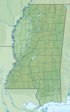
Relief location map of Mississippi, USA
Geographic limits of the map:
- N: 35.2° N
- S: 29.9° N
- W: 91.9° W
- E: 87.9° W


