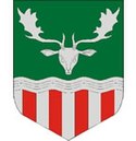
Tamási
 Miasto z lotu ptaka | |||||
| |||||
| Państwo | |||||
|---|---|---|---|---|---|
| Komitat | Tolna | ||||
| Powierzchnia | 111,96 km² | ||||
| Populacja (I 2011) • liczba ludności • gęstość | 8449 75,46 os./km² | ||||
| Nr kierunkowy | 74 | ||||
| Kod pocztowy | 7190 | ||||
| Strona internetowa | |||||
| Portal | |||||
Tamási – miasto na Węgrzech, w komitacie Tolna, siedziba władz powiatu Tamási.
Bibliografia
Kontrola autorytatywna (miasto na Węgrzech):
Media użyte na tej stronie
Hungary location map.svg
Autor: NordNordWest (dyskusja · edycje), Licencja: CC BY-SA 3.0
Location map of Hungary
Autor: NordNordWest (dyskusja · edycje), Licencja: CC BY-SA 3.0
Location map of Hungary
Tamási légifotó1.jpg
Autor: Civertan, Licencja: CC-BY-SA-3.0
Towered building is the Town hall. Right of the Town hall is the market. - Kossuth square and around, Tamási, Tolna County, Hungary, aerialphotography
Autor: Civertan, Licencja: CC-BY-SA-3.0
Towered building is the Town hall. Right of the Town hall is the market. - Kossuth square and around, Tamási, Tolna County, Hungary, aerialphotography
HUN Tamási COA.jpg
Coat of arms of Tamási, Hungary
Coat of arms of Tamási, Hungary


