Tannheim (Austria)
 | |||
| |||
| Państwo | |||
|---|---|---|---|
| Kraj związkowy | |||
| Powiat | |||
| Powierzchnia | 51,31 km² | ||
| Wysokość | 1097 m n.p.m. | ||
| Populacja (1 stycznia 2015) • liczba ludności |
| ||
| • gęstość | 20 os./km² | ||
| Numer kierunkowy | 05675 | ||
| Kod pocztowy | 6675 | ||
| Tablice rejestracyjne | RE | ||
| Strona internetowa | |||
Tannheim – gmina w Austrii, w kraju związkowym Tyrol, w powiecie Reutte. Według Austriackiego Urzędu Statystycznego liczyła 1042 mieszkańców (1 stycznia 2015)[1].
Przypisy
Media użyte na tej stronie
Autor: Rosso Robot, Licencja: CC BY-SA 3.0
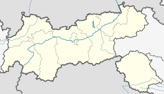
Location map of The Tyrol
Equirectangular projection. Geographic limits of the map:
- N: 47.75317° N
- S: 46.64119° N
- W: 10.08236° E
- E: 12.98961° E
Autor: Lencer, Licencja: CC BY-SA 3.0
Location map of Austria
Equirectangular projection, N/S stretching 150 %. Geographic limits of the map:
- N: 49.2° N
- S: 46.3° N
- W: 9.4° E
- E: 17.2° E
Autor: Bene16, Licencja: CC-BY-SA-3.0
St. Nikolaus in Tannheim (Tirol). Die Kirche steht im Tannheimer Tal. Das Tannheimer Tal liegt in der nordwestlichsten Ecke des Österreichischen Bundeslandes Tirol
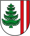
Blazon:„Argent, ahead a abie vert and left two pales gules.“
The arms were officially granted on May 8, 1984. The abie (Tanne) is a canting element. The left part shows the banner of Austria as the Dukes of Austria, as Counts of Tyrol, acquired the area in late medieval times and made Tannheim one of their local capitals.


