Tarangambadi
 | |
| Państwo | |
|---|---|
| Populacja (2006) • liczba ludności |
|
| Kod pocztowy | 609313 |
Położenie na mapie Indii | |
Tarangambadi (tamilski: தரங்கம்பாடி - Taraṅkampāṭi - /ˈtʌrʌŋɡʌmˌbaːʈi/, kiedyś Tranquebar) – port historyczny z fortem Dansborg i okolicznymi wioskami rybackimi w dystrykcie Nagapattinam na południowo-wschodnim wybrzeżu Tamilnadu w Indiach.
W przeszłości było to ważne miasto handlowe, kolonia duńska znana jako Tranguebar. Posiadało własne monety i sławną drukarnię misjonarzy, w której drukowano literaturę w języku angielskim i tamilskim. w roku 1712 wydano tu także trzecie wydanie Nowego Testamentu z Biblii Almeidy.
Miasto było głównym ośrodkiem luterańskiego misjonarstwa w Tamil Nadu. W XX wieku przez jakiś czas - siedziba biskupstwa Tamilskiego Ewangelicznego Kościoła Luterańskiego (Tamil Evangelical Lutheran Church = Tamil Suvishesha Lutheran Tirusabai) z kościołem Nowego Jerusalem.
Tranquebar w 1845 r. zostało sprzedane przez Duńczyków Brytyjczykom.
Liczba mieszkańców miasta 21 621 (dane z 1 stycznia 2006).
Tsunami z 26 grudnia 2004 roku przeszło przez miasto niszcząc okoliczne wioski rybackie i przyczyniając się do śmierci wielu mieszkańców. Odbudowę miasta Tarangambadi i okolicznych wiosek finansują liczne organizacje pomocy z Indii i z zagranicy, a także kościoły współpracujące z miastem.
Zobacz też
Linki zewnętrzne
- strona o Tranguebarze. trankebar.net. [zarchiwizowane z tego adresu (2002-04-22)].
Media użyte na tej stronie
Autor: Maximilian Dörrbecker (Chumwa), Licencja: CC BY-SA 3.0
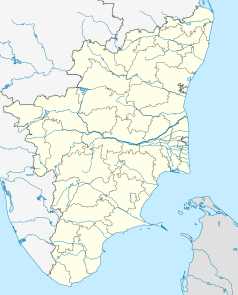
Location map of Tamil Nadu
(c) Uwe Dedering z niemieckiej Wikipedii, CC BY-SA 3.0
Location map of India.
Equirectangular projection. Strechted by 106.0%. Geographic limits of the map:
- N: 37.5° N
- S: 5.0° N
- W: 67.0° E
- E: 99.0° E
The Flag of India. The colours are saffron, white and green. The navy blue wheel in the center of the flag has a diameter approximately the width of the white band and is called Ashoka's Dharma Chakra, with 24 spokes (after Ashoka, the Great). Each spoke depicts one hour of the day, portraying the prevalence of righteousness all 24 hours of it.
Autor: Koshy Koshy from Faridabad, Haryana, India, Licencja: CC BY 2.0
A view of what is today known as ?The Bungalow on the Beach? Resort, run by the Neemrana Hotels. This was indeed a majestic building dating back to the 18th Century, built by the Danish East India Company in what was once a pepper trading post of Tranquebar. The Tamil village of Tharangambadi, which translate to ?The Singing Waves?, was once a Danish colony set up by Adminral Ove Gedde with a sea fort ?Dansborg? and several Lutheran Protestant Churches was once a flourishing sea port and centre of pepper trade. This bungalow, situated at the end of the King?s Street, past the Memorial of the Lutheran Protestant evangelist Bartholomaus Ziegenblog, who has to his credit 24 ?Firsts? including the first Protestant Missionary in India, the First Danish preacher in India, the first to translate The Bible in Tamil, The first to set up a printing press in India, the first to start a paper mill in India, and it goes on? was in a state of dilapidation till the innovative hotel chain purchased it in a state of disrepair and restored it with Tender Loving Care and converted it into a heritage hotel. This area was among the worst hit during the Tsunami


