Tensta
| dzielnica (stadsdel) Sztokholmu | |
 Tensta. Widok z drogi E18 (2009) | |
| Państwo | |
|---|---|
| Region | |
| Miasto | |
| Dzielnica | |
| Data założenia | 1967 |
| Powierzchnia | 4,23 km² |
| Populacja (2020) • liczba ludności |
|
| • gęstość | 4329 os./km² |
| Strona internetowa | |
| Portal | |
Tensta – dzielnica (stadsdel) Sztokholmu, położona w jego zachodniej części (Västerort) i wchodząca w skład stadsdelsområde Spånga-Tensta. Graniczy z dzielnicami Akalla, Husby, Rinkeby, Bromsten, Solhem i Lunda oraz z gminą Järfälla.
Dzielnica Tensta położona jest na południe od Järvafältet. Zachodnia część dzielnicy nazywana jest Hjulsta. Tensta była budowana w latach 1966–1972 w ramach tzw. miljonprogrammet. Pierwsze mieszkania oddano do użytku w 1967 r. Wśród zabudowy dominują typowe dla miljonprogrammet wielokondygnacyjne bloki mieszkalne.
Według danych opublikowanych przez gminę Sztokholm, 31 grudnia 2020 r. Tensta liczyła 18 313 mieszkańców[1]. Powierzchnia dzielnicy wynosi łącznie 4,23 km². Do Tensty zaliczane jest 2,23 km² niezamieszkałych obszarów zielonych położonych na południe od potoku Igelbäcken na Järvafältet, wchodzących w skład dzielnic Akalla (1,76 km²) i Husby (0,47 km²) (dzielnica administracyjna Rinkeby-Kista). Za utrzymanie tych terenów odpowiedzialna jest dzielnica administracyjna Spånga-Tensta[2].
Na terenie dzielnicy położone są dwie stacje niebieskiej linii (T10) sztokholmskiego metra, Tensta i Hjulsta.
Przypisy
- ↑ Statistisk årsbok för Stockholm 2022. Stockholms stad. s. 89. [dostęp 2022-09-18]. [zarchiwizowane z tego adresu (2022-03-04)]. (szw.).
- ↑ Stockholms stad: Areal och befolkningstäthet i stadsdelsområden, SDN-delar och stadsdelar 2014-12-31. Stockholm. [dostęp 2016-02-16]. (szw.).
Bibliografia
- Göran Söderström: Stockholm utanför tullarna. Nittiosju stadsdelar i ytterstaden. Sztokholm: Stockholmia Förlag, 2004. ISBN 91-7031-132-3.
- Stockholms gatunamn. Sztokholm: Stockholmia Förlag, 2005. ISBN 91-7031-152-8.
Linki zewnętrzne
Media użyte na tej stronie
Autor: Erik Frohne, Licencja: CC BY 3.0
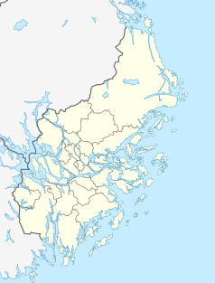
Location map of Stockholm County in Sweden
Equirectangular projection, N/S stretching 197 %. Geographic limits of the map:
- N: 60.30° N
- S: 58.70° N
- W: 17.10° E
- E: 19.50° E
Autor: Koyos, Licencja: CC BY-SA 2.5
This coat of arms was drawn based on its blazon which – being a written description – is free from copyright. Any illustration conforming with the blazon of the arms is considered to be heraldically correct. Thus several different artistic interpretations of the same coat of arms can exist. The design officially used by the armiger is likely protected by copyright, in which case it cannot be used here.
Individual representations of a coat of arms, drawn from a blazon, may have a copyright belonging to the artist, but are not necessarily derivative works.


