Teram Kangri
| ||
| Państwo | ||
| Pasmo | Karakorum | |
| Wysokość | 7462 m n.p.m. | |
| Wybitność | 1702 m | |
| Pierwsze wejście | 10 sierpnia 1975 K. Kodaka i Y. Kobayashi | |
Teram Kangri (chiń. 特拉木坎力; pinyin: Tèlāmùkǎnlì) – masyw w łańcuchu Siachen Muztagh, który jest częścią Karakorum. W masywie tym znajduje się najwyższy szczyt Siachen Muztagh – Teram Kangri I. Masyw leży na kwestionowanej granicy między Indiami a Chinami. Prawa do tych terenów rości sobie także Pakistan.
Szczyty masywu:
- Teram Kangri I - 7462 m,
- Teram Kangri II - 7407 m,
- Teram Kangri III - 7382 m.
Pierwszego wejścia na Teram Kangri I dokonali członkowie japońskiej ekspedycji prowadzonej przez H. Katayamę: K. Kodaka i Y. Kobayashi. 13 sierpnia zdobyli także Teram Kangri II. Teram Kangri III po raz pierwszy zdobyli M. Kudo, J. Kurotaki i M. Oka w 1979 r.
Bibliografia
- Jerzy Wala, Orographical Sketch Map of the Karakoram, Swiss Foundation for Alpine Research, Zurich, 1990.
- Jill Neate, High Asia: an illustrated history of the 7,000 metre peaks, The Mountaineers, 1989.
- Himalayan Index
Media użyte na tej stronie
Autor: Uwe Dedering, Licencja: CC BY-SA 3.0
Location map of India.
Equirectangular projection. Stretched by 106.0%. Geographic limits of the map:
- N: 37.5° N
- S: 5.0° N
- W: 67.0° E
- E: 99.0° E
The Flag of India. The colours are saffron, white and green. The navy blue wheel in the center of the flag has a diameter approximately the width of the white band and is called Ashoka's Dharma Chakra, with 24 spokes (after Ashoka, the Great). Each spoke depicts one hour of the day, portraying the prevalence of righteousness all 24 hours of it.
Black up-pointing triangle ▲, U+25B2 from Unicode-Block Geometric Shapes (25A0–25FF)
Autor: Uwe Dedering, Licencja: CC BY-SA 3.0
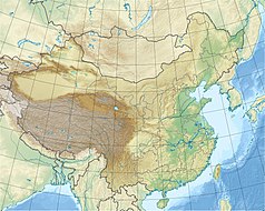
Location map of China.
EquiDistantConicProjection : Central parallel :
* N: 36.0° N
Central meridian :
* E: 104.0° E
Standard parallels :
* 1: 30.0° N
* 2: 42.0° N
Latitudes on the central meridian :
* top: 57.0° N
* center: 37.29° N
* bottom: 17.96° N
Made with Natural Earth. Free vector and raster map data @ naturalearthdata.com.


