Tetov
| gmina | |||||
 | |||||
| Państwo | |||||
|---|---|---|---|---|---|
| Kraj | |||||
| Powiat | Pardubice | ||||
| Kraina | Czechy | ||||
| Powierzchnia | 4,61 km² | ||||
| Populacja (2014) • liczba ludności | 162[1] | ||||
| Kod pocztowy | 533 16 | ||||
| Szczegółowy podział administracyjny | |||||
| Liczba obrębów ewidencyjnych | 1 | ||||
| Liczba części gminy | 1 | ||||
| Liczba gmin katastralnych | 1 | ||||
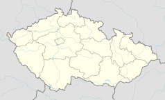
Położenie na mapie Czech (c) Karte: NordNordWest, Lizenz: Creative Commons by-sa-3.0 de | |||||
| Strona internetowa | |||||
| Portal | |||||
Tetov – wieś i gmina w Czechach, w powiecie Pardubice, w kraju pardubickim. 1 stycznia 2014 liczyła 162 mieszkańców[1].
Przypisy
- ↑ a b Počty obyvatel v obcích k 1. 1. 2014 (cz.). www.mvcr.cz. [dostęp 2015-12-10].
Media użyte na tej stronie
Czech Republic adm location map.svg
(c) Karte: NordNordWest, Lizenz: Creative Commons by-sa-3.0 de
Location map of the Czech Republic
(c) Karte: NordNordWest, Lizenz: Creative Commons by-sa-3.0 de
Location map of the Czech Republic
Tetov hostinec.JPG
Autor: Petr1888, Licencja: CC BY-SA 4.0
Tetov hostinec
Autor: Petr1888, Licencja: CC BY-SA 4.0
Tetov hostinec
| Pozycja fotografa |
|
To i inne zdjęcia na: OpenStreetMap |
|
|---|

|
This file was created as a part of the photographic program of Wikimedia Czech Republic. Project: Foto českých obcí The program supports Wikimedia Commons photographers in the Czech Republic. |
Pardubice Region.png
Autor: Afil, Licencja: CC BY-SA 3.0
Location map of Pardubice Region in the Czech Republic
Autor: Afil, Licencja: CC BY-SA 3.0
Location map of Pardubice Region in the Czech Republic
Tetov CoA.jpg
Coat of Arms of Tetov, Pardubice District, Czech Republic.
Coat of Arms of Tetov, Pardubice District, Czech Republic.
Flag of Tetov.jpg
Flag of Tetov, Pardubice District, Czech Republic.
Flag of Tetov, Pardubice District, Czech Republic.
Flag of Pardubice Region.svg
Flag of Pardubice Region
Flag of Pardubice Region


