The Forum Shops at Caesars
 Wejście do Forum Shops | |
| Państwo | |
|---|---|
| Adres | 3500 Las Vegas Boulevard South |
| Typ budynku | centrum handlowe |
| Ukończenie budowy | 1 stycznia 1992 |
| Strona internetowa | |
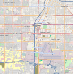
The Forum Shops at Caesars – luksusowe centrum handlowe o powierzchni 59.100 m², połączone z Caesars Palace, leżące przy bulwarze Las Vegas Strip w Las Vegas, w stanie Nevada. Podobnie jak sam Caesars Palace, tak i wystrój The Forum Shops utrzymany jest w stylu Imperium Rzymskiego. Wnętrza wypełniają antyczne fontanny, statuy i fasady.

The Forum Shops pod koniec lat 00. XXI wieku stanowiło najbardziej dochodowe centrum handlowe w Stanach Zjednoczonych (ze średnią wartością sprzedaży przypadającą na jeden kilometr kwadratowy wynoszącą ok. 1.400 dolarów), wyprzedzając słynne Rodeo Drive w Beverly Hills[1].
Obiekt liczy ponad 160 sklepów i butików haute couture, a także 15 restauracji.
The Forum Shops otwarte jest każdego dnia, 24 godziny na dobę.
Ekskluzywne butiki
The Forum Shops są siedzibą luksusowych butików, z których część, to jedyne oddziały danych marek na Zachodnim Wybrzeżu, poza tzw. Greater Los Angeles. Wśród nich są m.in.:
|
|
Przypisy
Linki zewnętrzne
- Strona oficjalna The Forum Shops at Caesars. simon.com. [zarchiwizowane z tego adresu (2006-03-20)]. (ang.)
Media użyte na tej stronie
Autor: , Licencja: CC BY-SA 2.0
Autor: Uwe Dedering, Licencja: CC BY-SA 3.0
Location map of the USA (without Hawaii and Alaska).
EquiDistantConicProjection:
Central parallel:
* N: 37.0° N
Central meridian:
* E: 96.0° W
Standard parallels:
* 1: 32.0° N
* 2: 42.0° N
Made with Natural Earth. Free vector and raster map data @ naturalearthdata.com.
Formulas for x and y:
x = 50.0 + 124.03149777329222 * ((1.9694462586094064-({{{2}}}* pi / 180))
      * sin(0.6010514667026994 * ({{{3}}} + 96) * pi / 180))
y = 50.0 + 1.6155950752393982 * 124.03149777329222 * 0.02613325650382181
      - 1.6155950752393982  * 124.03149777329222 *
     (1.3236744353715044  - (1.9694462586094064-({{{2}}}* pi / 180))
      * cos(0.6010514667026994 * ({{{3}}} + 96) * pi / 180))
The flag of Navassa Island is simply the United States flag. It does not have a "local" flag or "unofficial" flag; it is an uninhabited island. The version with a profile view was based on Flags of the World and as a fictional design has no status warranting a place on any Wiki. It was made up by a random person with no connection to the island, it has never flown on the island, and it has never received any sort of recognition or validation by any authority. The person quoted on that page has no authority to bestow a flag, "unofficial" or otherwise, on the island.
Autor: , Licencja: CC BY-SA 2.0
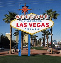
The Welcome to Fabulous Las Vegas Sign
Autor: Pedro Szekely from Los Angeles, USA, Licencja: CC BY-SA 2.0
A view of the Caesar's Palace Forum Shops just after sunrise. Sunrise and night are very different in Las Vegas, as one would expect. There's nobody on the street at sunrise, except for a few people who are just calling it a night.
The building is beautifully lit with purple light.
ISO 100, 11mm, f6.3, (0.1, 0.5, 1.6) sec. Processed as an HDR using Photomatix Exposure Fusion. This gave a bit more detail in the shadows and inside the building.


