The Oval (Londyn)
 | |
| The Kia Oval | |
| Państwo | |
|---|---|
| Kraj | |
| Miejscowość | |
| Data otwarcia | 1845 |
| Właściciel | |
| Klub | Surrey County Cricket Club |
| Inauguracja | 10 marca 1845 (mecz krykietowy)[1] |
| Pojemność stadionu | 23 500 |
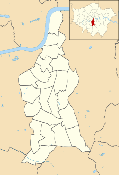
Położenie na mapie gminy Lambeth Contains Ordnance Survey data © Crown copyright and database right, CC BY-SA 3.0 | |
Położenie na mapie Wielkiej Brytanii (c) Karte: NordNordWest, Lizenz: Creative Commons by-sa-3.0 de | |
Położenie na mapie Wielkiego Londynu Contains Ordnance Survey data © Crown copyright and database right, CC BY-SA 3.0 | |
| 51°29′01,390″N 0°06′53,930″W/51,483719 -0,114981 | |
| Strona internetowa | |
The Oval (od nazwy sponsora nazywany również Kia Oval, w przeszłości Kennington Oval) – stadion krykietowy w Kennington, w Londynie. Na obiekcie tym swoje mecze rozgrywa drużyna Surrey County Cricket Club. Odbywają się na nim także krykietowe mecze testowe. W XIX wieku był areną 22 meczów finałowych Pucharu Anglii[3] oraz 12 spotkań piłkarskiej reprezentacji Anglii[4]. W latach siedemdziesiątych XIX wieku na stadionie odbyło się także kilka meczów narodowej reprezentacji rugbystów[5].
Mecze reprezentacji Anglii w piłce nożnej
| Data | Wynik | Rozgrywki | Zwycięzca |
|---|---|---|---|
| 5 marca 1870 | 1:1 | mecz towarzyski | |
| 19 listopada 1870 | 1:0 | mecz towarzyski | |
| 25 lutego 1871 | 1:1 | mecz towarzyski | |
| 17 listopada 1871 | 2:1 | mecz towarzyski | |
| 24 lutego 1872 | 1:0 | mecz towarzyski | |
| 8 marca 1873 | 4:2 | mecz towarzyski | |
| 6 marca 1875 | 2:2 | mecz towarzyski | |
| 3 marca 1877 | 1:3 | mecz towarzyski | |
| 5 kwietnia 1879 | 5:4 | mecz towarzyski | |
| 12 marca 1881 | 1:6 | mecz towarzyski | |
| 21 marca 1885 | 1:1 | British Home Championship | |
| 13 kwietnia 1889 | 2:3 | British Home Championship |
Mecze finałowe Pucharu Anglii
| Rok | Widzów | Zwycięzca | Finalista | ||
|---|---|---|---|---|---|
| 1872 | 2000 | Wanderers | 1 | Royal Engineers | 0 |
| 1874 | 2000 | Oxford University | 2 | Royal Engineers | 0 |
| 1875 | 3000 | Royal Engineers | 1 | Old Etonians | 1 |
| Powtórka | 3000 | Royal Engineers | 2 | Old Etonians | 0 |
| 1876 | 3500 | Wanderers | 1 | Old Etonians | 1 |
| Powtórka | 1500 | Wanderers | 3 | Old Etonians | 0 |
| 1877 | 3000 | Wanderers | 2 | Oxford University | 1 |
| 1878 | 4500 | Wanderers | 3 | Royal Engineers | 1 |
| 1879 | 5000 | Old Etonians | 1 | Clapham Rovers | 0 |
| 1880 | 6000 | Clapham Rovers | 1 | Oxford University | 0 |
| 1881 | 4500 | Old Carthusians | 3 | Old Etonians | 0 |
| 1882 | 6500 | Old Etonians | 1 | Blackburn Rovers | 0 |
| 1883 | 8000 | Blackburn Olympic | 2 | Old Etonians | 1 |
| 1884 | 12 000 | Blackburn Rovers | 2 | Queen’s Park | 1 |
| 1885 | 12 500 | Blackburn Rovers | 2 | Queen’s Park | 0 |
| 1886 | 15 000 | Blackburn Rovers | 0 | West Bromwich Albion | 0 |
| 1887 | 15 500 | Aston Villa | 2 | West Bromwich Albion | 0 |
| 1888 | 19 000 | West Bromwich Albion | 2 | Preston North End | 1 |
| 1889 | 22 000 | Preston North End | 3 | Wolverhampton Wanderers | 0 |
| 1890 | 20 000 | Blackburn Rovers | 6 | Sheffield Wednesday | 1 |
| 1891 | 23 000 | Blackburn Rovers | 3 | Notts County | 1 |
| 1892 | 32 810 | West Bromwich Albion | 3 | Aston Villa | 0 |
Przypisy
- ↑ The Montpellier Tea Gardens, Walworth (ang.). thebeehivebar.co.uk. [dostęp 2011-10-31]. [zarchiwizowane z tego adresu (9 września 2011)].
- ↑ 5 March 1870: England v Scotland at The Oval (ang.). The Guardian. [dostęp 2011-10-31].
- ↑ 1872 - 1879 Finals, 1880 - 1889 Finals, 1890 - 1899 Finals (ang.). fa-cupfinals.co.uk. [dostęp 2011-10-31].
- ↑ Results (ang.). englandstats.com. [dostęp 2011-10-31].
- ↑ Historical Rugby Milestones 1870s (ang.). RugbyFootballHistory.com. [dostęp 2011-10-31].
Media użyte na tej stronie
Contains Ordnance Survey data © Crown copyright and database right, CC BY-SA 3.0
Blank map of the London Borough of Lambeth, showing electoral wards.
Equirectangular map projection on WGS 84 datum, with N/S stretched 160%
Geographic limits:
- West: 0.17W
- East: 0.05W
- North: 51.515N
- South: 51.405N
(c) Karte: NordNordWest, Lizenz: Creative Commons by-sa-3.0 de
Location map of the United Kingdom
Contains Ordnance Survey data © Crown copyright and database right, CC BY-SA 3.0
Map of Greater London, UK with the following information shown:
- Administrative borders
- Coastline, lakes and rivers
- Roads and railways
- Urban areas
The data includes both primary routes and railway lines.
Equirectangular map projection on WGS 84 datum, with N/S stretched 160%
Geographic limits:
- West: 0.57W
- East: 0.37E
- North: 51.72N
- South: 51.25N
Flag of England. Saint George's cross (a red cross on a white background), used as the Flag of England, the Italian city of Genoa and various other places.
Autor:
- Gfi-set01-stadium.png: gfi
- derivative work: Frédéric (talk)
icone pour terrain de sport
The new OCS Stand at the Vauxhall End of the Oval, as photographed from the top seating in the Pavilion on 17 April 2005 by self.
The pavilion at "The Oval" cricket Ground, London


