Thurso
 | |||
| |||
| Państwo | |||
|---|---|---|---|
| Kraj | |||
| Populacja • liczba ludności | 8 721 | ||
| Nr kierunkowy | 01847 | ||
| Kod pocztowy | KW-14 | ||
Położenie na mapie Highland Contains Ordnance Survey data © Crown copyright and database right, CC BY-SA 3.0 | |||
Położenie na mapie Wielkiej Brytanii (c) Karte: NordNordWest, Lizenz: Creative Commons by-sa-3.0 de | |||
Położenie na mapie Szkocji | |||
| Portal | |||
Thurso (gael. Inbhir Theòrsa) − miasto na północnym wybrzeżu Szkocji w regionie Caithness, założone prawdopodobnie przez wikingów ok. 1000 roku n.e.
Liczba mieszkańców w 2003 roku wynosiła ok. 8 tys.
Odpływają stąd promy na pobliskie Orkady. W pobliżu miasta znajduje się ośrodek badań jądrowych i nieczynna elektrownia jądrowa Dounreay Nuclear Power Development Establishment. W mieście znajduje się stacja kolejowa - położony najdalej na północy fragment sieci kolejowej Wielkiej Brytanii.
Linki zewnętrzne
- http://www.thurso.dth.pl - Thurso Galeria zdjęć
Media użyte na tej stronie
(c) Karte: NordNordWest, Lizenz: Creative Commons by-sa-3.0 de
Location map of the United Kingdom
(c) Eric Gaba, NordNordWest, CC BY-SA 3.0
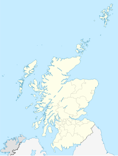
Location map of Scotland, United Kingdom
Autor: Mich Taylor, Licencja: CC BY-SA 3.0
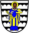
Argent; five barrulets sable, engrailed on their under edges, the figure of St Peter enhaloed, proper, vested azure and or, in his dexter hand two keys in saltire or and argent - Burgh of Thurso, Scotland
Contains Ordnance Survey data © Crown copyright and database right, CC BY-SA 3.0
Blank map of Highland, UK with the following information shown:
- Administrative borders
- Coastline, lakes and rivers
- Roads and railways
- Urban areas
Equirectangular map projection on WGS 84 datum, with N/S stretched 180%
Geographic limits:
- West: 6.9W
- East: 2.9W
- North: 58.8N
- South: 56.4N
Traill Street, Thurso


