Tierp
 | |||
| |||
| Państwo | |||
|---|---|---|---|
| Region | |||
| Gmina | Tierp | ||
| Powierzchnia | 4,44[1] km² | ||
| Populacja (2018) • liczba ludności • gęstość | 6143[1] 1383[1] os./km² | ||
| Portal | |||
Tierp – miejscowość (tätort) w środkowej części Szwecji. Siedziba władz administracyjnych gminy Tierp w regionie Uppsala.
Demografia
Liczba ludności Tierpu w latach 2000–2010.
Przypisy
- ↑ a b c Statistiska tätorter 2018; befolkning, landareal, befolkningstäthet (szw.). Statistikmyndigheten SCB, 2020-03-20. [dostęp 2020-09-08]. [zarchiwizowane z tego adresu (2020-03-24)].
- ↑ a b Szwedzki Urząd Statystyczny SCB (szw.). [dostęp 2017-03-05].
- ↑ SBC Statistiska centralbyrån: Landareal, folkmängd och invånartäthet (inv/km²), per tätort 2005 och 2010 [dostęp 2016-10-28] [zarchiwizowane z adresu 2016-03-03] (szw.).
Media użyte na tej stronie
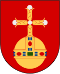
(c) Lokal_Profil, CC BY-SA 2.5
This coat of arms was drawn based on its blazon which – being a written description – is free from copyright. Any illustration conforming with the blazon of the arms is considered to be heraldically correct. Thus several different artistic interpretations of the same coat of arms can exist. The design officially used by the armiger is likely protected by copyright, in which case it cannot be used here.
Individual representations of a coat of arms, drawn from a blazon, may have a copyright belonging to the artist, but are not necessarily derivative works.
Autor: Erik Frohne, Licencja: CC BY 3.0
Location map of Uppsala county in Sweden
Equirectangular projection, N/S stretching 200 %. Geographic limits of the map:
- N: 60.80° N
- S: 59.30° N
- W: 16.60° E
- E: 18.90° E
Autor: Arild Vågen, Licencja: CC BY-SA 3.0
Railway station of Tierp. Built 1874, rebuilt 1905.
(c) Lokal_Profil, CC BY-SA 2.5
This coat of arms was drawn based on its blazon which – being a written description – is free from copyright. Any illustration conforming with the blazon of the arms is considered to be heraldically correct. Thus several different artistic interpretations of the same coat of arms can exist. The design officially used by the armiger is likely protected by copyright, in which case it cannot be used here.
Individual representations of a coat of arms, drawn from a blazon, may have a copyright belonging to the artist, but are not necessarily derivative works.


