Tiruvannamalai
| ||
 | ||
| Państwo | ||
| Nr kierunkowy | 4175 | |
| Kod pocztowy | 606601 | |
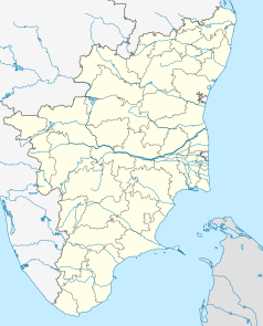
Położenie na mapie Indii | ||
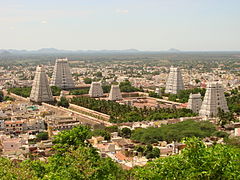
Tiruvannamalai (tamil. திருவண்ணாமலை) – stolica dystryktu Tiruvannamalai w podziale administracyjnym Tamilnadu. Leży 185 km od Ćennaj i 210 km od Bengaluru.
Tiruvannamalai położone jest u stóp góry Arunachala. Jest to jedno z pięciu świętych miejsc śiwaizmu, z których każde przypisany jest jednemu z żywiołów, będących miejscem przebywania boga Śiwy. Świątynia Tiruvannamalai reprezentuje ogień. Pozostałe to świątynia w Kańći (ziemia), w Ćidambaram - przestrzeń (akasam), Śri Kalahasti (powietrze), zaś Thiruvanaikaval (woda). Wokół Arunachali powstało wiele obiektów sakralnych i aśramów. Najsławniejszy z nich to Sri Ramanasramam, związany z postacią Śri Ramana Maharishi.
Zobacz też
- Ramana Maharishi
- Arunaćala pradakszina – pielgrzymka
Media użyte na tej stronie
(c) Uwe Dedering z niemieckiej Wikipedii, CC BY-SA 3.0
Location map of India.
Equirectangular projection. Strechted by 106.0%. Geographic limits of the map:
- N: 37.5° N
- S: 5.0° N
- W: 67.0° E
- E: 99.0° E
The Flag of India. The colours are saffron, white and green. The navy blue wheel in the center of the flag has a diameter approximately the width of the white band and is called Ashoka's Dharma Chakra, with 24 spokes (after Ashoka, the Great). Each spoke depicts one hour of the day, portraying the prevalence of righteousness all 24 hours of it.
Autor: Adam Jones Adam63, Licencja: CC BY-SA 3.0
View over Arunchaleshvara Temple from the Red Mountain, Tiruvannamalai, India. July 2008.
Autor: Maximilian Dörrbecker (Chumwa), Licencja: CC BY-SA 3.0
Location map of Tamil Nadu
Autor: Ilya Mauter, Licencja: CC BY-SA 3.0
Arunachaleshvara_Temple_Tiruvannamalai Tamil Nadu, India


