Torshälla
 Torshälla (2011) | |||
| |||
| Państwo | |||
|---|---|---|---|
| Region | |||
| Gmina | |||
| Powierzchnia | 9,33[1] km² | ||
| Populacja (2018) • liczba ludności • gęstość | |||
| Nr kierunkowy | (+46) 16 | ||
| Kod pocztowy | 644 xx | ||
| Strona internetowa | |||
| Portal | |||
Torshälla – miejscowość (tätort) w Szwecji, w regionie administracyjnym (län) Södermanland (gmina Eskilstuna). Do 1970 roku Torshälla miała administracyjny status miasta.
W 2015 roku Torshälla liczyła 8928 mieszkańców[2].
Położenie
Położona nad rzeką Eskilstunaån (Torshällaån), ok. 7 km na północ od centrum Eskilstuny w północno-zachodniej części prowincji historycznej (landskap) Södermanland na obszarze Rekarne.
Historia
Prawa miejskie nadane przez króla Birgera Magnussona[3]. Zachowany dokument został wystawiony w Nyköping i datowany jest na 24 lutego 1317 roku[4].
W 1971 roku, w wyniku reformy administracyjnej, miasto Torshälla (Torshälla stad) weszło w skład nowo utworzonej gminy Eskilstuna (Eskilstuna kommun)[3].
Demografia
Liczba ludności tätortu Torshälla w latach 1960–2015[5]:
Przypisy
- ↑ a b c Statistiska tätorter 2018; befolkning, landareal, befolkningstäthet (szw.). Statistikmyndigheten SCB, 2020-03-20. [dostęp 2020-09-08]. [zarchiwizowane z tego adresu (2020-03-24)].
- ↑ Statistiska centralbyrån: Tätorter 2015; befolkning, landareal, andel som överlappas av fritidshusområden (szw.). [dostęp 2017-01-12]. [zarchiwizowane z tego adresu (2017-11-07)].
- ↑ a b Vällkommen till Torshälla, s.2 (szw.). Eskilstuna kommun. [dostęp 2017-01-12]. [zarchiwizowane z tego adresu (2017-01-16)].
- ↑ SDHK-nr: 2792 (szw.). Riksarkivet. [dostęp 2017-01-12].
- ↑ Statistiska centralbyrån: Landareal per tätort, folkmängd och invånare per kvadratkilometer. Vart femte år 1960 - 2015 (szw.). [dostęp 2017-01-12]. [zarchiwizowane z tego adresu (2018-01-20)].
Linki zewnętrzne
Media użyte na tej stronie
(c) Lokal_Profil, CC BY-SA 2.5
This coat of arms was drawn based on its blazon which – being a written description – is free from copyright. Any illustration conforming with the blazon of the arms is considered to be heraldically correct. Thus several different artistic interpretations of the same coat of arms can exist. The design officially used by the armiger is likely protected by copyright, in which case it cannot be used here.
Individual representations of a coat of arms, drawn from a blazon, may have a copyright belonging to the artist, but are not necessarily derivative works.
Autor: Erik Frohne, Licencja: CC BY 3.0
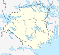
Location map of Södermanland county in Sweden
Equirectangular projection, N/S stretching 195 %. Geographic limits of the map:
- N: 59.60° N
- S: 58.50° N
- W: 15.50° E
- E: 17.80° E
Autor: Udo Schröter, Licencja: CC BY-SA 3.0
Torshälla, view over the city center
Autor: Marmelad
, Licencja: CC BY-SA 2.5
This coat of arms was drawn based on its blazon which – being a written description – is free from copyright. Any illustration conforming with the blazon of the arms is considered to be heraldically correct. Thus several different artistic interpretations of the same coat of arms can exist. The design officially used by the armiger is likely protected by copyright, in which case it cannot be used here.
Individual representations of a coat of arms, drawn from a blazon, may have a copyright belonging to the artist, but are not necessarily derivative works.
(c) Lokal_Profil, CC BY-SA 2.5
This coat of arms was drawn based on its blazon which – being a written description – is free from copyright. Any illustration conforming with the blazon of the arms is considered to be heraldically correct. Thus several different artistic interpretations of the same coat of arms can exist. The design officially used by the armiger is likely protected by copyright, in which case it cannot be used here.
Individual representations of a coat of arms, drawn from a blazon, may have a copyright belonging to the artist, but are not necessarily derivative works.


