Tour Ariane
| Państwo | |
|---|---|
| Miejscowość | |
| Adres | |
| Architekt | Robert Zammit, Jean de Mailly |
| Wysokość całkowita | 152 m |
| Wysokość do dachu | 152 m |
| Kondygnacje | 36 |
| Powierzchnia użytkowa | 57 300 m² |
| Rozpoczęcie budowy | |
| Ukończenie budowy | |
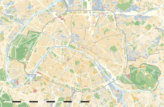
Położenie na mapie Paryża (c) Eric Gaba, Wikimedia Commons user Sting, CC BY-SA 3.0 | |
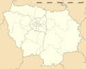
Położenie na mapie Île-de-France (c) Eric Gaba, Wikimedia Commons user Sting, CC BY-SA 3.0 | |
| Strona internetowa | |
Tour Ariane – wieżowiec w Paryżu, w dzielnicy La Défense, we Francji, o wysokości 152 m. Budynek został otwarty w 1975. Liczy 36 kondygnacji.
Zobacz też
Linki zewnętrzne
Media użyte na tej stronie
Autor: Superbenjamin, Licencja: CC BY-SA 4.0
Blank administrative map of France for geo-location purpose, with regions and departements distinguished. Approximate scale : 1:3,000,000
(c) Eric Gaba, Wikimedia Commons user Sting, CC BY-SA 3.0
Blank administrative map of the region of Île-de-France, France, as in January 2015, for geo-location purpose, with distinct boundaries for regions, departments and arrondissements.
(c) Eric Gaba, Wikimedia Commons user Sting, CC BY-SA 3.0
Blank land cover map of the city and department of Paris, France, as in January 2012, for geo-location purpose, with distinct boundaries for departments and arrondissements.


