Trinity (Jersey)
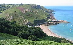
 Widok na niewielki port morski Trinity na Bouley Bay | |||||
| |||||
| Państwo | |||||
|---|---|---|---|---|---|
| Dependencja królewska | |||||
| Zarządzający | Philip Le Sueur[1] | ||||
| Powierzchnia | 13 km² | ||||
| Populacja (2011) • liczba ludności • gęstość |
| ||||
| Kod pocztowy | JE3-5 | ||||
Położenie na mapie Wielkiej Brytanii (c) Karte: NordNordWest, Lizenz: Creative Commons by-sa-3.0 de | |||||
| Strona internetowa | |||||
| Portal | |||||
Trinity (jèrriais La Trinneté, fr. La Trinité) - okręg (parish) na wyspie Jersey, jednej z Wysp Normandzkich. Okręg Trinity leży w północnej części wyspy. W parish-u znajduje się najwyższe wzniesienie wyspy - Les Platons.
Przypisy
Media użyte na tej stronie
(c) Karte: NordNordWest, Lizenz: Creative Commons by-sa-3.0 de
Location map of the United Kingdom
Autor: Flagvisioner, Licencja: CC0
Flag of the Trinity Parish in Jersey, according to File:Couleurs en Jèrri 08.jpg
Autor: OpenStreet Map contributors, Licencja: ODbL
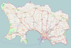
Map of Jersey (UK territory), intended for use in geolocation templates:
- top = 49.264
- bottom = 49.1568
- left = -2.2568
- right = -2.0151
Autor: TUBS
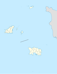
Location map of the Channel Islands
Coat of arms of Trinity parish, Jersey (British channel islands), containing a version of the Shield of the Trinity diagram. These arms appeared on a 1976 Jersey stamp and a 1988 Jersey coin. For different artistic renditions, see the sites http://www.ngw.nl/int/cha/trinity.htm , http://www.jeron.je/thatwasjersey/t.html etc.
Other version on Wikimedia Commons: Image:Blason ville uk La Trinité (Jersey).svg .


