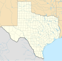
Trinity (Teksas)
| ||||
 | ||||
| Państwo | ||||
|---|---|---|---|---|
| Stan | ||||
| Hrabstwo | ||||
| Kod statystyczny | ||||
| Powierzchnia | 9,8 km² | |||
| Wysokość | 71 m n.p.m. | |||
| Populacja (2000) • liczba ludności • gęstość |
| |||
| Nr kierunkowy | 936 | |||
| Kod pocztowy | 75862 | |||
| Strefa czasowa | ||||
| Strona internetowa | ||||
| Portal | ||||
Trinity – miasto w Stanach Zjednoczonych, w stanie Teksas, w hrabstwie Trinity.
Przypisy
- ↑ American FactFinder - Community Facts. [dostęp 2014-12-01]. [zarchiwizowane z tego adresu (2015-01-18)].
Media użyte na tej stronie
Autor: Alexrk, Licencja: CC BY 3.0
Ta mapa została stworzona za pomocą GeoTools.
Autor: Uwe Dedering, Licencja: CC BY-SA 3.0
Location map of the USA (without Hawaii and Alaska).
EquiDistantConicProjection:
Central parallel:
* N: 37.0° N
Central meridian:
* E: 96.0° W
Standard parallels:
* 1: 32.0° N
* 2: 42.0° N
Made with Natural Earth. Free vector and raster map data @ naturalearthdata.com.
Formulas for x and y:
x = 50.0 + 124.03149777329222 * ((1.9694462586094064-({{{2}}}* pi / 180))
      * sin(0.6010514667026994 * ({{{3}}} + 96) * pi / 180))
y = 50.0 + 1.6155950752393982 * 124.03149777329222 * 0.02613325650382181
      - 1.6155950752393982  * 124.03149777329222 *
     (1.3236744353715044  - (1.9694462586094064-({{{2}}}* pi / 180))
      * cos(0.6010514667026994 * ({{{3}}} + 96) * pi / 180))
The flag of Navassa Island is simply the United States flag. It does not have a "local" flag or "unofficial" flag; it is an uninhabited island. The version with a profile view was based on Flags of the World and as a fictional design has no status warranting a place on any Wiki. It was made up by a random person with no connection to the island, it has never flown on the island, and it has never received any sort of recognition or validation by any authority. The person quoted on that page has no authority to bestow a flag, "unofficial" or otherwise, on the island.
Autor: Steven L. Driskell (SDriskell), Licencja: CC BY-SA 3.0
Old Red Schoolhouse. Trinity's first schoolhouse was a one-room log structure built in 1872 near Cedar Grove Cemetery. A two-story frame schoolhouse that stood on this site from 1897 to 1911 was moved several blocks northwest to serve African American students. Under Supt. J. Woolam Bright, construction of a new brick building began here in 1911, and after many delays it opened by 1915. The Prairie Style, T-Plan building housed all grade levels until completion of an adjacent High School in 1928. "Old Red" served as a schoolhouse for 80 years. When it was slated for demolition in the 1990s, concerned citizens and former students worked with the School District to preserve the historic building for continued use. Recorded Texas Historic Landmark - 2004. Listed in the National Register of Historic Places by the United States Department of the Interior.


