Trouley-Labarthe
| miejscowość i gmina | |||
 | |||
| |||
| Państwo | |||
|---|---|---|---|
| Region | |||
| Departament | |||
| Okręg | |||
| Kod INSEE | 65454 | ||
| Powierzchnia | 4,33 km² | ||
| Populacja (1990) • liczba ludności |
| ||
| • gęstość | 15 os./km² | ||
| Kod pocztowy | 65140 | ||
Położenie na mapie Pirenejów Wysokich © Hawk-Eye, CC BY-SA 3.0 | |||
| Portal | |||
Trouley-Labarthe – miejscowość i gmina we Francji, w regionie Oksytania, w departamencie Pireneje Wysokie.
Według danych na rok 1990 gminę zamieszkiwało 65 osób, a gęstość zaludnienia wynosiła 15 osób/km² (wśród 3020 gmin regionu Midi-Pireneje Trouley-Labarthe plasuje się na 998. miejscu pod względem liczby ludności, natomiast pod względem powierzchni na miejscu 1546.).
Bibliografia
- Francuski urząd statystyczny. (fr.).
Media użyte na tej stronie
Autor: Superbenjamin, Licencja: CC BY-SA 4.0
Blank administrative map of France for geo-location purpose, with regions and departements distinguished. Approximate scale : 1:3,000,000
Autor: Flappiefh, Licencja: CC BY-SA 4.0
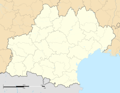
Carte administrative vierge de la région Languedoc-Roussillon-Midi-Pyrénées, France, destinée à la géolocalisation.
Autor: Sotos, Licencja: CC BY-SA 4.0
Trouley-Labarthe (Hautes-Pyrénées)
Autor: Celbusro, Licencja: CC BY-SA 3.0
Blasonnement : de sinople au tourteau de gueules ouvert en forme de croix latine du champ, accompagné des inscriptions SPES FIDES en chef et CARITAS en pointe, le tout en lettres capitales italiques de sable (armes fautives). Source site passion Bigorre
© Hawk-Eye, CC BY-SA 3.0
Blank administrative map of the department of Hautes-Pyrénées, France, for geo-location purpose.


