Tvrdonice
| |||||
 | |||||
| Państwo | |||||
| Kraj | południowomorawski | ||||
| Powierzchnia | 21,15 km² | ||||
| Wysokość | 176 m n.p.m. | ||||
| Populacja (1.1.2012) • liczba ludności • gęstość | 2113 99,9 os./km² | ||||
| Kod pocztowy | 691 53 | ||||
| Tablice rejestracyjne | BV | ||||
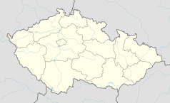
Położenie na mapie Czech (c) Karte: NordNordWest, Lizenz: Creative Commons by-sa-3.0 de | |||||
| Strona internetowa | |||||
| Portal | |||||
Tvrdonice (niem. Turnitz) - wieś na Morawach, w Czechach, w kraju południowomorawskim.
Linki zewnętrzne
Kontrola autorytatywna (gmina w Czechach):
Media użyte na tej stronie
Czech Republic adm location map.svg
(c) Karte: NordNordWest, Lizenz: Creative Commons by-sa-3.0 de
Location map of the Czech Republic
(c) Karte: NordNordWest, Lizenz: Creative Commons by-sa-3.0 de
Location map of the Czech Republic
Tvrdonice, kostel.jpg
Autor: palickap, Licencja: CC BY 3.0
This photograph was taken within the scope of the third year of the 'Czech Municipalities Photographs' grant.
Autor: palickap, Licencja: CC BY 3.0
This photograph was taken within the scope of the third year of the 'Czech Municipalities Photographs' grant.


