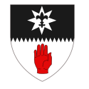
Tyrone (hrabstwo)
| hrabstwo | |||||
| |||||
| Państwo | |||||
|---|---|---|---|---|---|
| Prowincja | |||||
| Siedziba | Omagh | ||||
| Powierzchnia | 3263 km² | ||||
| Populacja (2011) • liczba ludności | 177 986 | ||||
Położenie na mapie Irlandii Północnej | |||||
| Portal | |||||
Tyrone (wym. [tɪˈrəʊn]; irl. Contae Tír Eoghain) – jedno z sześciu hrabstw położonych w irlandzkiej prowincji Ulster, wchodzących w skład brytyjskiej Irlandii Północnej. Położone w północnej części wyspy. Hrabstwo graniczy z hrabstwem Londonderry na północy, Fermanagh na południowym zachodzie, z dwoma hrabstwami Republiki Irlandii: Donegal na zachodzie i Monaghan na południu, oraz z hrabstwami Armagh i Antrim przez Lough Neagh na wschodzie.
Stolicą hrabstwa jest miasto Omagh.
Media użyte na tej stronie
Ulster Banner is a heraldic banner taken from the former coat of arms of Northern Ireland. It was used by the Northern Ireland government in 1953-1973 with Edwardian crown since coronation of Queen Elizabeth II, based earlier design with Tudor Crown from 1924. Otherwise known as the Ulster Flag, Red Hand of Ulster Flag, Red Hand Flag.
Ulster Banner is a heraldic banner taken from the former coat of arms of Northern Ireland. It was used by the Northern Ireland government in 1953-1973 with Edwardian crown since coronation of Queen Elizabeth II, based earlier design with Tudor Crown from 1924. Otherwise known as the Ulster Flag, Red Hand of Ulster Flag, Red Hand Flag.
Autor:
- Island of Ireland location map.svg:
- Ireland location map.svg: NordNordWest
- Northern Ireland location map.svg: NordNordWest
- Northern Ireland - Counties.png: Maximilian Dörrbecker (Chumwa)
- Rannpháirtí anaithnid
- derivative work: Mabuska
The island of Ireland, showing international border between Northern Ireland and Republic of Ireland, traditional provinces, traditional counties, and local authority areas in the Republic of Ireland and Northern Ireland.


