Uig
 | |
| Państwo | |
|---|---|
| Kraj | |
| Hrabstwo | |
| Nr kierunkowy | 01470 |
| Kod pocztowy | IV51 |
Położenie na mapie Highland Contains Ordnance Survey data © Crown copyright and database right, CC BY-SA 3.0 | |
Położenie na mapie Wielkiej Brytanii (c) Karte: NordNordWest, Lizenz: Creative Commons by-sa-3.0 de | |
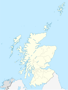
Położenie na mapie Szkocji | |
| Portal | |
Uig (gael. An Ùig) – największa wieś na półwyspie Trotternish, na wyspie Skye w archipelagu Hebrydów Wewnętrznych. Leży nad zatoką Uig, będącą częścią zatoki Loch Snizort.
Terminal promów do Lochmaddy na North Uist i do Tarbert na Harris. Browar, wytwórnia ceramiki artystycznej, hotele.
Zobacz też
Linki zewnętrzne
Media użyte na tej stronie
(c) Karte: NordNordWest, Lizenz: Creative Commons by-sa-3.0 de
Location map of the United Kingdom
The flag of the United Kingdom (3:5 version). This flag is the Union Flag in the 3:5 ratio exclusively used on land. At sea, the correct ratio is 1:2.
Autor: Klaus with K (talk), Licencja: CC-BY-SA-3.0
The village of Uig lies in a sheltered bay near the north end of the Isle of Skye (Inner Hebrides).
Contains Ordnance Survey data © Crown copyright and database right, CC BY-SA 3.0
Blank map of Highland, UK with the following information shown:
- Administrative borders
- Coastline, lakes and rivers
- Roads and railways
- Urban areas
Equirectangular map projection on WGS 84 datum, with N/S stretched 180%
Geographic limits:
- West: 6.9W
- East: 2.9W
- North: 58.8N
- South: 56.4N
(c) Eric Gaba, NordNordWest, CC BY-SA 3.0
Location map of Scotland, United Kingdom


