Ujae
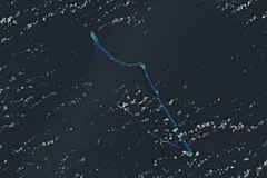
 Atol Ujae na zdjęciu NASA z 2001 roku | |
| Państwo | |
|---|---|
| Akwen | Ocean Spokojny |
| Powierzchnia | 1,86 km² |
| Populacja (2011) • liczba ludności | 364 |
Ujae – zamieszkany atol na Wyspach Marshalla na Oceanie Spokojnym. Należy do łańcucha wysp Ralik Chain. Według danych za rok 2011 atol zamieszkiwało łącznie 364 osoby (spadek w stosunku do 1999 roku, kiedy to liczba ta wynosiła 440), na wyspach znajdowały się 52 domy[1]. Zlokalizowany jest tu także port lotniczy (kod IATA: UJE)[2].
Atol został odkryty przez Ruy'a Lópeza de Villalobosa w 1543[3].
Geografia i przyroda
Ujae należy do łańcucha wysp Ralik Chain, leży 47 km na zachód od atolu Lea i 122 km na zachód od Kwajalein. Składa się z 14 wysp (według innego źródła wysp jest 15[4]) m.in. Ujae i Enylamiej[5] o łącznej powierzchni 1,86 km². Łączna powierzchnia laguny wynosi 185,94 km²[6]. Długość atolu wynosi 47 km, jego kształt przypomina grot włóczni skierowany w kierunku południowo-wschodnim[7]. W przeszłości atol określano nazwami: Catherine Islands, Katherine Islands, Lydia, Margaret, Serpent, Udjae i Ujamilai[6].
W 1967 r. stwierdzono występowanie na Ujae 14 gatunków ptaków, w tym 4 lęgowych (Sterna fuscata, Thalasseus bergii, Anous stolidus i Anous tenuirostris) i 9 potencjalnie lęgowych[8]. Na atolu spotkać można następujące gatunki roślin: Caesalpinia bonduc, Cenchrus echinatus, Centella asiatica, Citrus aurantiifolia, Eleusine indica, Eragrostis amabilis, Euphorbia prostrata, Gomphrena globosa, Ipomoea violacea, Nerium oleander, Phyllanthus amarus, Physalis angulata, Portulaca oleracea i Pseuderanthemum carruthersii[9].
Przypisy
- ↑ Economic Policy, Planning, and Statistics Office, Office of the President: The RMI 2011 Census of Population and Housing. Summary and Highlights Only (ang.). U.S. Department of the Interior, 2012-02-14. [dostęp 2016-07-26]. [zarchiwizowane z tego adresu (2020-03-02)].
- ↑ UJE - Ujae Atoll, MH - Airport - Great Circle Mapper (ang.). Great Circle Mapper. [dostęp 2016-07-26].
- ↑ Max Quanchi, John Robson: Historical Dictionary of the Discovery and Exploration of the Pacific Islands. Lanham, Maryland; Toronto; Oxford: The Scarecrow Press, Inc., 2005, s. XX. ISBN 0-8108-5395-7.
- ↑ Republic of the Marshall Islands - Ujae Atoll (ang.). Republic of the Marshall Islands Embassy, USA, 2002. [dostęp 2016-07-26].
- ↑ William T. Bringham: An Index to the Islands of the Pacific Ocean. Honolulu: Bishop Museum Press, 1900, s. 160.
- ↑ a b Atoll Information--Ujae Atoll (Marshall Islands) (ang.). marshalls digital micronesia, 1998-05. [dostęp 2016-07-26].
- ↑ Marshall Islands - Ujae (ang.). the island encyklopedia. [dostęp 2016-07-26].
- ↑ A. Binion Amerson Jr.: Atoll Research Bulletin No. 127: Ornitology of the Marshall and Gilbert Islands. Waszyngton, U.S.A.: The Smithsonian Institute, 1969, s. 146–147. (ang.)
- ↑ Plant Threats to Pacific Ecosystems: Ujae Atoll (ang.). Hawaiian Ecosystems at Risk project. [dostęp 2016-08-02].
Linki zewnętrzne
- Atoll information--Ujae Atoll (Marshall Islands) - Map from 1881 (ang.). marshalls digital micronesia. [dostęp 2016-07-26].
Media użyte na tej stronie
Autor: NordNordWest, Licencja: CC BY 3.0
Location map of the Marshall Islands
Autor: Uwe Dedering, Licencja: CC BY-SA 3.0
Relief location map of Oceania.
- Projection: Lambert azimuthal equal-area projection.
- Area of interest:
- N: 35.0° N
- S: -55.0° N
- W: 110.0° E
- E: 230.0° E (This is -130° E)
- Projection center:
- NS: -10.0° N
- WE: 170.0° E
- GMT projection: -JA170/-5/20c
- GMT region: -R79.58168799459713/-44.42200097096855/-120.83787447194456/33.90289238708686r
- GMT region for grdcut: -R80.0/-63.0/260.0/39.0r
- Relief: SRTM30plus.
- Made with Natural Earth. Free vector and raster map data @ naturalearthdata.com.
Ujae-Atoll


