Uniwersytet De Montfort
 Uniwersytet De Montfort | |
| Data założenia | 1992 |
|---|---|
| Typ | publiczna |
| Patron | |
| Państwo | |
| Adres | The Gateway, Leicester, LE1 9BH |
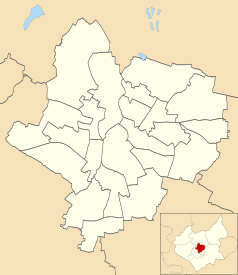
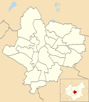
Położenie na mapie Leicesteru Contains Ordnance Survey data © Crown copyright and database right, CC BY-SA 3.0 | |
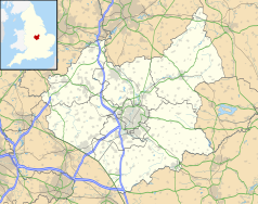
Położenie na mapie Wielkiej Brytanii (c) Karte: NordNordWest, Lizenz: Creative Commons by-sa-3.0 de | |
Położenie na mapie Leicestershire Contains Ordnance Survey data © Crown copyright and database right, CC BY-SA 3.0 | |
| Strona internetowa | |

Uniwersytet De Montfort (DMU - De Montfort University) – wyższa szkoła państwowa powstała w 1992 r. w mieście Leicester w Wielkiej Brytanii[1]. Nazwa uniwersytetu pochodzi od Simon V de Montfort szóstego hrabiego z XIII wieku.
Uczelnia prowadzi szereg kierunków i kursów na różnych wydziałach[2].
Kierunki i kursy
- Administracja w Biznesie
- Animacja
- Architektura
- Zarządzanie i Marketing
- Biznes Międzynarodowy
- Cyfryzacja i Media Społecznościowe
- Dziennikarstwo
- Ekonomia
- Ekonomia i Finanse
- Ekonomia i Polityka
- Elektrotechnika
- Farmacja
- Filmoznawstwo
- Filologia Angielska
- Finanse i rachunkowość
- Finanse i Zarządzanie
- Fotografia
- Gospodarka Mieszkaniowa
- Grafika
- Handel w Modzie
- Historia
- Informatyka
- Informatyka i Komunikacja
- Informatyka Śledcza
- Inżynieria Biomedyczna
- Inżynieria Oprogramowania
- Kryminalistyka, Kryminologia
- Logopedia
- Matematyka
- Mechanika i budowa maszyn
- Mechatronika
- Media
- Komunikacja i Dziennikarstwo
- Medioznawstwo
- Muzyka, Muzyka i Nagrywanie Dźwięku, Muzyka i Technologia
- Ochrona Zdrowia
- Pedagogika
- Pielęgniarstwo
- Politologia
- Położnictwo
- Praca w Opiece Społecznej, Praca z młodzieżą
- Prawo, Prawo Handlowe
- Produkcja Telewizyjna
- Programowanie Gier Komputerowych, Projektowanie gier komputerowych
- Psychologia, Psychologia i Edukacja, Psychologia i Kryminologia
- Reklama i Media
- Socjologia
- Stosunki międzynarodowe
- Teatrologia
- Zarządzanie Biznesem Międzynarodowym
- Zarządzanie w Biznesie i Marketing
- Zarządzanie w Handlu Detalicznym
- Zarządzanie w Sztuce i Organizacja Imprez Masowych
- Zarządzanie Zasobami Ludzkimi
Zobacz też
- Uniwersytet Leicester
Linki zewnętrzne
Przypisy
- ↑ De Montfort University – Leicester, UK 2014
- ↑ De Montfort University. [dostęp 2014-03-08]. [zarchiwizowane z tego adresu (2014-03-08)].
Media użyte na tej stronie
(c) Karte: NordNordWest, Lizenz: Creative Commons by-sa-3.0 de
Location map of the United Kingdom
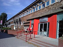
Autor: Jack O'Sullivan, Licencja: CC BY 2.0
Fletcher Building of De Montfort University.
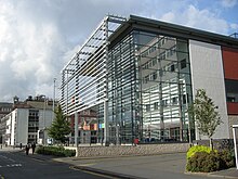
(c) David Williams, CC BY-SA 2.0
This modern building reflects the progress and ambition of Leicester's De Montfort University. It is the centre of the campus and has a number of fast-food outlets and cafes. It's a busy hub of University life during term time.
Contains Ordnance Survey data © Crown copyright and database right, CC BY-SA 3.0
Map of Leicester, Leicestershire, UK with electoral wards shown.
Equirectangular map projection on WGS 84 datum, with N/S stretched 160%
Geographic limits:
- West: 1.22W
- East: 1.04W
- North: 52.70N
- South: 52.57N
Contains Ordnance Survey data © Crown copyright and database right, CC BY-SA 3.0
Map of Leicestershire, UK with the following information shown:
- Administrative borders
- Coastline, lakes and rivers
- Roads and railways
- Urban areas
Equirectangular map projection on WGS 84 datum, with N/S stretched 160%
Geographic limits:
- West: 1.80W
- East: 0.50W
- North: 53.00N
- South: 52.36N
Autor: Jack O'Sullivan, Licencja: CC BY 2.0
Hawthorn Building of De Montfort University.
Autor: Jack O'Sullivan, Licencja: CC BY 2.0
Queens Building of De Montfort University.
Autor: Kris1973, Licencja: CC BY-SA 4.0
Sciana z napisem Uniwersytetu
Autor: NotFromUtrecht, Licencja: CC BY-SA 3.0
A statue of Simon de Montfort on the Haymarket Memorial Clock Tower in Leicester, England.
