Untersiggenthal
 | |||
| |||
| Państwo | |||
|---|---|---|---|
| Kanton | |||
| SFOS | 4044 | ||
| Powierzchnia | 8,36 km² | ||
| Wysokość | 371 m n.p.m. | ||
| Populacja (31 grudnia 2014) • liczba ludności • gęstość |
| ||
| Nr kierunkowy | 056 | ||
| Kod pocztowy | 5417 | ||
| Tablice rejestracyjne | AG | ||
 | |||
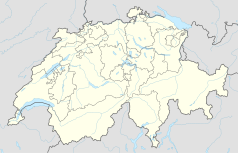
Położenie na mapie Szwajcarii (c) Karte: NordNordWest, Lizenz: Creative Commons by-sa-3.0 de | |||
| Strona internetowa | |||
Untersiggenthal – gmina w Szwajcarii, w kantonie Argowia, w okręgu Baden. Liczba mieszkańców 31 grudnia 2014 roku wynosiła 7079.
Bibliografia
- Szwajcarski Urząd Statystyczny
Media użyte na tej stronie
(c) Karte: NordNordWest, Lizenz: Creative Commons by-sa-3.0 de
Location map of Switzerland
Autor: Roland zh, Licencja: CC BY-SA 3.0
Limmat in Vogelsang (Gebenstorf), Gebäude im Hintergrund in Untersiggenthal
Autor: Abaddon1337, Licencja: CC BY-SA 3.0
Fork from media:Karte Kanton Aargau Bezirke 2010.png for geolocalisation
Autor: Sa-se, Licencja: CC-BY-SA-3.0
Wappen der Aargauer Gemeinde Untersiggenthal


