Uterga
| |||
 | |||
| |||
| Państwo | |||
| Wspólnota autonomiczna | Nawarra | ||
| Prowincja | Nawarra | ||
| Alkad | Pedro Maria Nagore Lanas | ||
| Powierzchnia | 8,63[1] km² | ||
| Populacja (2011) • liczba ludności • gęstość | 195[1] 22,60 os./km² | ||
| Kod pocztowy | 31133 | ||
| Tablice rejestracyjne | NA | ||
Położenie na mapie Nawarry (c) Miguillen, CC BY-SA 3.0 | |||
| Portal | |||
Uterga – gmina w Hiszpanii, w prowincji Nawarra, w Nawarze, o powierzchni 8,63[1] km². W 2011 roku gmina liczyła 195[1] mieszkańców.
Gmina jest jednym z punktów dla pielgrzymów na Drodze św. Jakuba, udających się do Santiago de Compostela.
Przypisy
- ↑ a b c d Ministerio de Hacienda y Administraciones Públicas: Datos del registro de Entidades Locales (hiszp.). [dostęp 2013-06-16].
Media użyte na tej stronie
Autor: NordNordWest, Licencja: CC BY-SA 3.0
Location map of Spain
Equirectangular projection, N/S stretching 130 %. Geographic limits of the map:
- N: 44.4° N
- S: 34.7° N
- W: 9.9° W
- E: 4.8° E
Autor: Pedro A. Gracia Fajardo, escudo de Manual de Imagen Institucional de la Administración General del Estado, Licencja: CC0
Flaga Hiszpanii
Flag of Navarre (Spain) Article 7.2. of the LORAFNA stipulates: “The flag of Navarre is red, with the coat of arms in the centre. Source: Symbols of Navarre - Gobierno de Navarra
Autor: Miguillen, Licencja: CC BY-SA 3.0
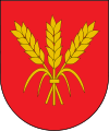
Escudo del municipio de Uterga (Navarra), según blasón: En campo de gules , tres espigas de trigo de oro puestas en haz.Fuente: Jesús Lorenzo Otazu Ripa, Heráldica Municipal Merindad de Pamplona (III),pg 19 Navarra. Temas de Cultura Popular nº 304, Ed. Gobierno de Navarra, 1978, ISBN 842351329
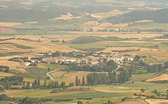
Uterga desde El Perdón


