Větřkovice
| gmina | |||||
 Miejscowy kościół | |||||
| |||||
| Państwo | |||||
|---|---|---|---|---|---|
| Kraj | |||||
| Powiat | Opawa | ||||
| Kraina | Morawy i Śląsk | ||||
| Powierzchnia | 17,83 km² | ||||
| Populacja (2012) • liczba ludności | 761[1] | ||||
| Kod pocztowy | 747 43 | ||||
| Szczegółowy podział administracyjny | |||||
| Liczba obrębów ewidencyjnych | 2 | ||||
| Liczba części gminy | 2 | ||||
| Liczba gmin katastralnych | 2 | ||||
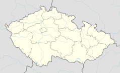
Położenie na mapie Czech (c) Karte: NordNordWest, Lizenz: Creative Commons by-sa-3.0 de | |||||
| Strona internetowa | |||||
| Portal | |||||
Větřkovice – gmina w Czechach, w powiecie Opawa, w kraju morawsko-śląskim. Według danych z dnia 1 stycznia 2012 liczyła 761 mieszkańców[1].
Przypisy
- ↑ a b Počty obyvatel v obcích k 1. 1. 2012 (cz.). www.mvcr.cz. [dostęp 2012-02-16].
Media użyte na tej stronie
Moravian-Silesian Region - outline map.svg
Autor: Caroig, Licencja: CC BY-SA 3.0
Outline map of the Moravian-Silesian Region, Czechia, ready for the Geobox template, calibrated at en:Template:Geobox locator Moravian-Silesian Region
Autor: Caroig, Licencja: CC BY-SA 3.0
Outline map of the Moravian-Silesian Region, Czechia, ready for the Geobox template, calibrated at en:Template:Geobox locator Moravian-Silesian Region
Czech Republic adm location map.svg
(c) Karte: NordNordWest, Lizenz: Creative Commons by-sa-3.0 de
Location map of the Czech Republic
(c) Karte: NordNordWest, Lizenz: Creative Commons by-sa-3.0 de
Location map of the Czech Republic
Flag of Moravian-Silesian Region.svg
Flag of Moravian-Silesian Region
Flag of Moravian-Silesian Region
Flag Czech Town Větřkovice.svg
Flag of Větřkovice, Opava District
Flag of Větřkovice, Opava District
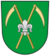
Coa Czech Town Větřkovice.svg
The coat of arms of Větřkovice
The coat of arms of Větřkovice
Vetrkovice-2008-05-26-Kostel.JPG
Church in Větřkovice
Church in Větřkovice


