Vale of Glamorgan
| hrabstwo miejskie | |
| Państwo | |
|---|---|
| Księstwo | |
| Siedziba | |
| Powierzchnia | 335 km² |
| Populacja • liczba ludności |
|
| • gęstość | 365 os./km² |
Położenie na mapie Walii | |
| Portal | |
Vale of Glamorgan (wal. Bro (lub Dyffryn) Morgannwg) – hrabstwo miejskie w południowej Walii. Od północy graniczy z miastem Cardiff i hrabstwami miejskimi Rhondda Cynon Taf i Bridgend.
Miejscowości
Na terenie hrabstwa znajdują się następujące miejscowości[1][2] (w nawiasach liczba ludności w 2011[3]):
- Barry (54 673)
- Penarth (27 226)
- Llantwit Major (8427)
- Dinas Powys (7490)
- Rhoose (6160)
- St Athan (5554)
- Cowbridge (3804)
- Wenvoe (1155)
- Ogmore-by-Sea (878)
- Ewenny (768)
- St Brides Major (741)
- Wick (698)
- St Donat′s (555)
- St Nicholas (417)
- Llanmaes (403)
- Bonvilston (392)
Mapa
Zobacz też
Przypisy
- ↑ a b Office for National Statistics: Built-up Area to Local Authority District (December 2011) Lookup in England and Wales (ang.). W: Open Geography Portal [on-line]. [dostęp 2022-06-05].
- ↑ a b Office for National Statistics: Built-up Area Sub Divisions (December 2011) Boundaries (ang.). W: Open Geography Potal [on-line]. [dostęp 2022-06-05].
- ↑ a b Office for National Statistics: KS101EW - Usual resident population (ang.). W: 2011 Census [on-line]. Nomis – Official labour market statistics, 2013-02-12. [dostęp 2022-06-05].
Media użyte na tej stronie
Autor: TUBS
Location of unitary authority area Vale of Glamorgan in Wales in Wales.
Contains Ordnance Survey data © Crown copyright and database right, CC BY-SA 3.0
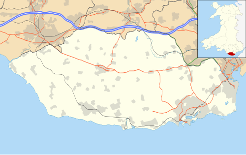
Blank map of the Vale of Glamorgan, UK with the following information shown:
- Administrative borders
- Coastline, lakes and rivers
- Roads and railways
- Urban areas
Equirectangular map projection on WGS 84 datum, with N/S stretched 160%
Geographic limits:
- West: 3.66W
- East: 3.15W
- North: 51.55N
- South: 51.35N


