Vanves
| miejscowość i gmina | |||
 | |||
| |||
| Państwo | |||
|---|---|---|---|
| Region | |||
| Departament | |||
| Okręg | |||
| Kod INSEE | 92075 | ||
| Powierzchnia | 1,56 km² | ||
| Populacja (2012) • liczba ludności |
| ||
| • gęstość | 17 543 os./km² | ||
| Kod pocztowy | 92170 | ||
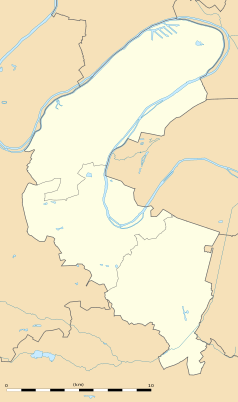
Położenie na mapie Hauts-de-Seine (c) Eric Gaba, Wikimedia Commons user Sting, CC BY-SA 3.0 | |||
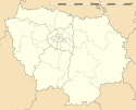
Położenie na mapie Île-de-France (c) Eric Gaba, Wikimedia Commons user Sting, CC BY-SA 3.0 | |||
| Portal | |||
Vanves – miejscowość i gmina we Francji, w regionie Île-de-France, w departamencie Hauts-de-Seine.
Według danych na rok 2012 gminę zamieszkiwało 27 367 osób, a gęstość zaludnienia wynosiła 17 543 osób/km². Wśród 1287 gmin regionu Île-de-France Vanves plasuje się na 876. miejscu pod względem powierzchni.
W 1835 w Vanves zmarł Bonawentura Niemojowski.
Współpraca
Zobacz też
- Cerkiew Świętej Trójcy i Nowych Męczenników Rosyjskich w Vanves
Bibliografia
- Francuski urząd statystyczny. (fr.).
Media użyte na tej stronie
Autor: Superbenjamin, Licencja: CC BY-SA 4.0
Blank administrative map of France for geo-location purpose, with regions and departements distinguished. Approximate scale : 1:3,000,000
(c) Eric Gaba, Wikimedia Commons user Sting, CC BY-SA 3.0
Blank administrative map of the region of Île-de-France, France, as in January 2015, for geo-location purpose, with distinct boundaries for regions, departments and arrondissements.
Ulster Banner is a heraldic banner taken from the former coat of arms of Northern Ireland. It was used by the Northern Ireland government in 1953-1973 with Edwardian crown since coronation of Queen Elizabeth II, based earlier design with Tudor Crown from 1924. Otherwise known as the Ulster Flag, Red Hand of Ulster Flag, Red Hand Flag.
Ulster Banner is a heraldic banner taken from the former coat of arms of Northern Ireland. It was used by the Northern Ireland government in 1953-1973 with Edwardian crown since coronation of Queen Elizabeth II, based earlier design with Tudor Crown from 1924. Otherwise known as the Ulster Flag, Red Hand of Ulster Flag, Red Hand Flag.
Flag of Israel. Shows a Magen David (“Shield of David”) between two stripes. The Shield of David is a traditional Jewish symbol. The stripes symbolize a Jewish prayer shawl (tallit).
Autor: Patricia.fidi, Licencja: CC0
Unofficial (de facto) flag of the region Île-de-France in France. It was also the flag of the kingdom of France (s.XIV-XV)
Autor: Alt0160, Licencja: CC BY-SA 3.0
Photographie du carrefour Albert-Legris, situé à Vanves.
(c) Eric Gaba, Wikimedia Commons user Sting, CC BY-SA 3.0
Blank administrative map of the department of the Hauts-de-Seine, France, as in January 2015, for geo-location purpose, with distinct boundaries for departments and arrondissements.
Map of Paris and its inner ring départements, localization of Vanves (Author: Metropolitan).


