Vaulandry
| miejscowość | |||
 Kościół w Vaulandry | |||
| |||
| Państwo | |||
|---|---|---|---|
| Region | |||
| Departament | |||
| Okręg | |||
| Kod INSEE | 49380 | ||
| Powierzchnia | 26,9 km² | ||
| Populacja (2008) • liczba ludności |
| ||
| Kod pocztowy | 49150 | ||
Położenie na mapie Maine i Loary (c) Eric Gaba, Wikimedia Commons user Sting, CC BY-SA 3.0 | |||
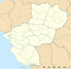
Położenie na mapie Kraju Loary (c) Eric Gaba, Wikimedia Commons user Sting, CC BY-SA 3.0 | |||
| Portal | |||
Vaulandry – miejscowość i dawna gmina we Francji, w regionie Kraj Loary, w departamencie Maine i Loara. W 2008 roku jej populacja wynosiła 298 mieszkańców[1].
W dniu 1 stycznia 2013 roku z połączenia dwóch ówczesnych gmin – Clefs oraz Vaulandry – utworzono nową gminę Clefs-Val d’Anjou. Siedzibą gminy została miejscowość Clefs[2]. Następnie 1 stycznia 2016 roku miejscowość weszła w skład gminy Baugé-en-Anjou[3].
Przypisy
- ↑ Populations légales 2013. INSEE. [dostęp 2016-12-10]. (fr.).
- ↑ Arrêté du 19 novembre 2012 portant création de la commune nouvelle de Clefs-Val d’Anjou. legifrance. [dostęp 2016-12-10]. (fr.).
- ↑ Recueil des Actes Administratif. maine-et-loire.gouv.fr. [dostęp 2016-12-10]. (fr.).
Media użyte na tej stronie
(c) Eric Gaba, Wikimedia Commons user Sting, CC BY-SA 3.0
Blank administrative map of the department of Maine-et-Loire, France, as in January 2018, for geo-location purpose, with distinct boundaries for regions, departments and arrondissements.
Autor: Superbenjamin, Licencja: CC BY-SA 4.0
Blank administrative map of France for geo-location purpose, with regions and departements distinguished. Approximate scale : 1:3,000,000
(c) Eric Gaba, Wikimedia Commons user Sting, CC BY-SA 3.0
Blank administrative map of the region of Pays de la Loire, France, as in February 2011, for geo-location purpose, with distinct boundaries for regions, departments and arrondissements.
Autor: Chatsam, Licencja: CC BY-SA 3.0
blason de la commune de Vaulandry : Écartelé: au 1er d'or au chardon de sinople, fleuri de gueules et mouvant d'un croissant du même, au 2e de sinople au pairle d'argent, la branche senestre alésée et aiguisé, chargé de quatre fers de moulin de sable posés à plomb, au 3e de sinople à la tour d'or, maçonnée de sable, ouverte et ajourée du champ, au 4e d'or au sanglier de sable surmonté de deux pommes de pin au naturel
Autor: Skouame, Licencja: CC BY-SA 3.0
This building is inscrit au titre des monuments historiques de la France. It is indexed in the base Mérimée, a database of architectural heritage maintained by the French Ministry of Culture, under the reference PA00109413


