Victoria Park (Leicester)
| ||
 Victoria Park | ||
| Państwo | ||
| Miejscowość | Leicester | |
| Powierzchnia | 27,9 ha | |
| Data założenia | 1882 | |
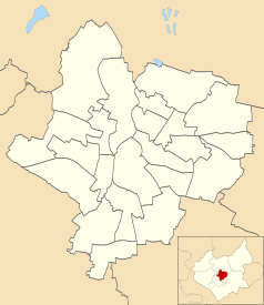
Położenie na mapie Leicesteru Contains Ordnance Survey data © Crown copyright and database right, CC BY-SA 3.0 | ||
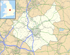
Położenie na mapie Wielkiej Brytanii (c) Karte: NordNordWest, Lizenz: Creative Commons by-sa-3.0 de | ||
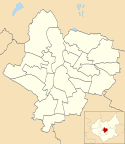
Położenie na mapie Leicestershire Contains Ordnance Survey data © Crown copyright and database right, CC BY-SA 3.0 | ||
| Strona internetowa | ||
Victoria Park – park położony w południowo-wschodniej części miasta Leicester, o powierzchni 27,9 hektarów (279 000 m²), otwarty w 1882 r. Obok parku znajduje się University of Leicester, De Montfort Hall. Park otaczają dwie główne ulice London Road (A6), Victoria Park Road (B568), oraz Granville Road. Blisko parku znajduje się dworzec kolejowy, w odległości sześciuset metrów.
Park posiada zaplecze do uprawiania sportów m.in.: tenisa, koszykówki, krykieta, piłki nożnej.
W parku organizowane są imprezy plenerowe: Caribbean Carnival oraz Leicester Pride. Istnieje również budynek, gdzie znajduje się kawiarnia, bar, restauracja.
Na terenie parku znajduje się pomnik The War Memorial[1].
Zobacz też
- Abbey Park
- Nelson Mandela Park
- Spinney Hill Park (Leicester)
Przypisy
- ↑ Victoria Park, www.leicester.gov.uk [dostęp 2017-11-20] (ang.).
Media użyte na tej stronie
(c) Karte: NordNordWest, Lizenz: Creative Commons by-sa-3.0 de
Location map of the United Kingdom
Shiny green button/marker widget.
Autor: NotFromUtrecht, Licencja: CC BY-SA 3.0
Victoria Park, looking NE from Queens Road.
Contains Ordnance Survey data © Crown copyright and database right, CC BY-SA 3.0
Map of Leicester, Leicestershire, UK with electoral wards shown.
Equirectangular map projection on WGS 84 datum, with N/S stretched 160%
Geographic limits:
- West: 1.22W
- East: 1.04W
- North: 52.70N
- South: 52.57N
Contains Ordnance Survey data © Crown copyright and database right, CC BY-SA 3.0
Map of Leicestershire, UK with the following information shown:
- Administrative borders
- Coastline, lakes and rivers
- Roads and railways
- Urban areas
Equirectangular map projection on WGS 84 datum, with N/S stretched 160%
Geographic limits:
- West: 1.80W
- East: 0.50W
- North: 53.00N
- South: 52.36N
Autor: NotFromUtrecht, Licencja: CC BY-SA 3.0
The War Memorial, Victoria Park, Leicester. The Memorial was designed by Edwin Lutyens and erected in 1923; it is the youngest Grade I listed building in Leicester.


