Vila Velha
| |||||
 | |||||
| Państwo | |||||
|---|---|---|---|---|---|
| Stan | |||||
| Powierzchnia | 208,820 km² | ||||
| Wysokość | 4 m n.p.m. | ||||
| Populacja (2007) • liczba ludności • gęstość | 398 068 1906,3 os./km² | ||||
| Nr kierunkowy | 27 | ||||
| Kod pocztowy | 29100 | ||||
| Strona internetowa | |||||
Vila Velha (dawniej Espírito Santo) – miasto we wschodniej Brazylii, w stanie Espírito Santo, nad Oceanem Atlantyckim, w pobliżu miasta Vitória. Około 394,8 tys. mieszkańców.
Media użyte na tej stronie
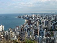
Praia da Costa. Neighborhood at Vila Velha, brazilian city.
Autor:
- EspiritoSanto_MesoMicroMunicip.svg: Raphael Lorenzeto de Abreu
- derivative work: Milenioscuro (talk)
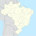
Location map of Espírito Santo state.
Equirectangular projection, N/S stretching 106 %. Geographic limits of the map:
- N: 17.75° S
- S: 21.41° S
- W: 42.02° W
- E: 39.5° W
Flag of the State of Espírito Santo, Brazil.
(c) Ferabreu, CC-BY-SA-3.0
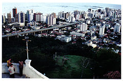
Parte da Terceira Ponte e Praia da Costa vistos a partir do Convento da Penha. Vila Velha, Espírito Santo, Brasil. Foto: Fernando Abreu
Autor: Reorganizador, Licencja: CC BY-SA 4.0
Bandeira de Vila Velha


